- Filter By:
-
-
Stock photos and images of username:dpreezg

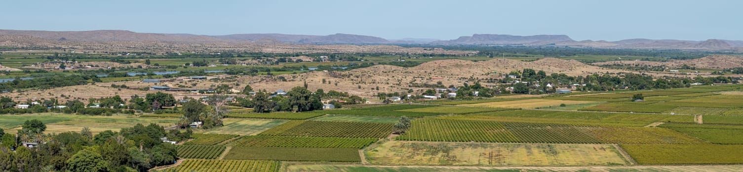
West view from Tierberg. Vineyards' Orange River visible
Stock PhotoUsername
dpreezgResolution
8595x2000pxWest view from Tierberg. Vineyards' Orange River visible

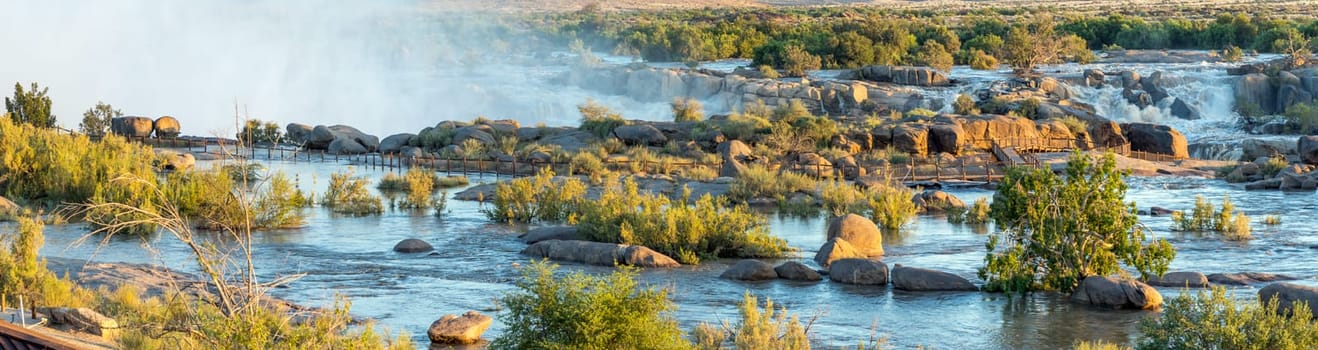
Boardwalk to the main Augrabies waterfall
Stock PhotoUsername
dpreezgResolution
9036x2400pxBoardwalk to the main Augrabies waterfall

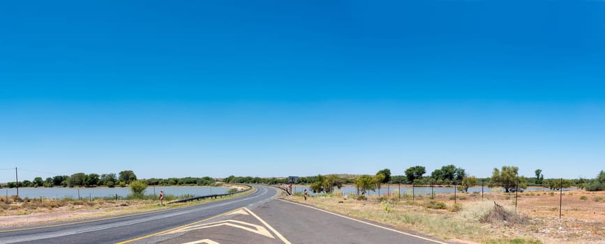
Balancing dam for the canal system between Groblershoop and Upington
Stock PhotoUsername
dpreezgResolution
5945x2400pxBalancing dam for the canal system between Groblershoop and Upington

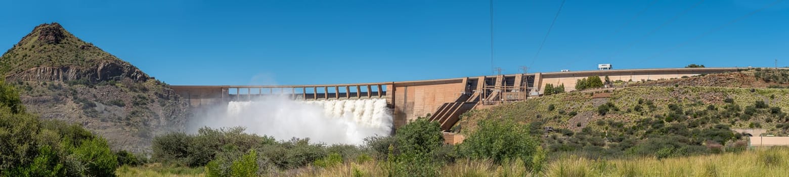
Panorama of the Vanderkloof Dam overflowing
Stock PhotoUsername
dpreezgResolution
10702x2400pxPanorama of the Vanderkloof Dam overflowing

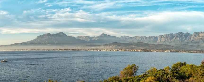
Panoramic view from Clarence Drive towards Gordons Bay
Stock PhotoUsername
dpreezgResolution
4436x1800pxPanoramic view from Clarence Drive towards Gordons Bay
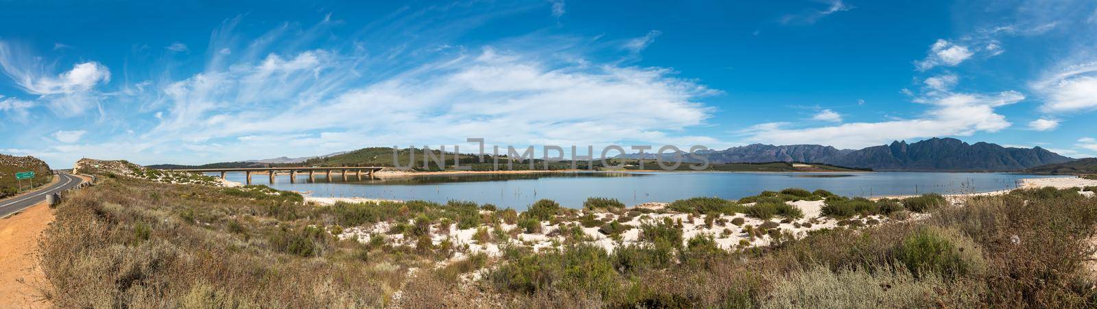
Theewaterskloof Dam in the Western Cape Province
Stock PhotoUsername
dpreezgResolution
8514x2400pxTheewaterskloof Dam in the Western Cape Province

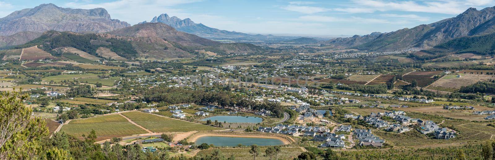
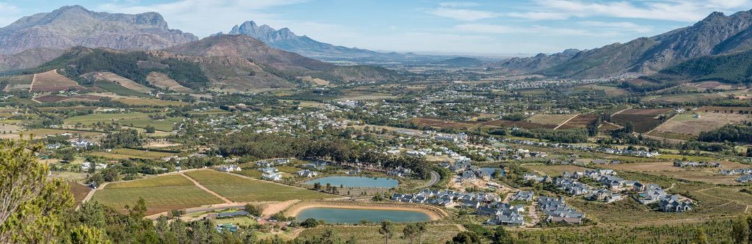
Panoramic view of Franschhoek
Stock PhotoUsername
dpreezgResolution
6163x2000pxPanoramic view of Franschhoek
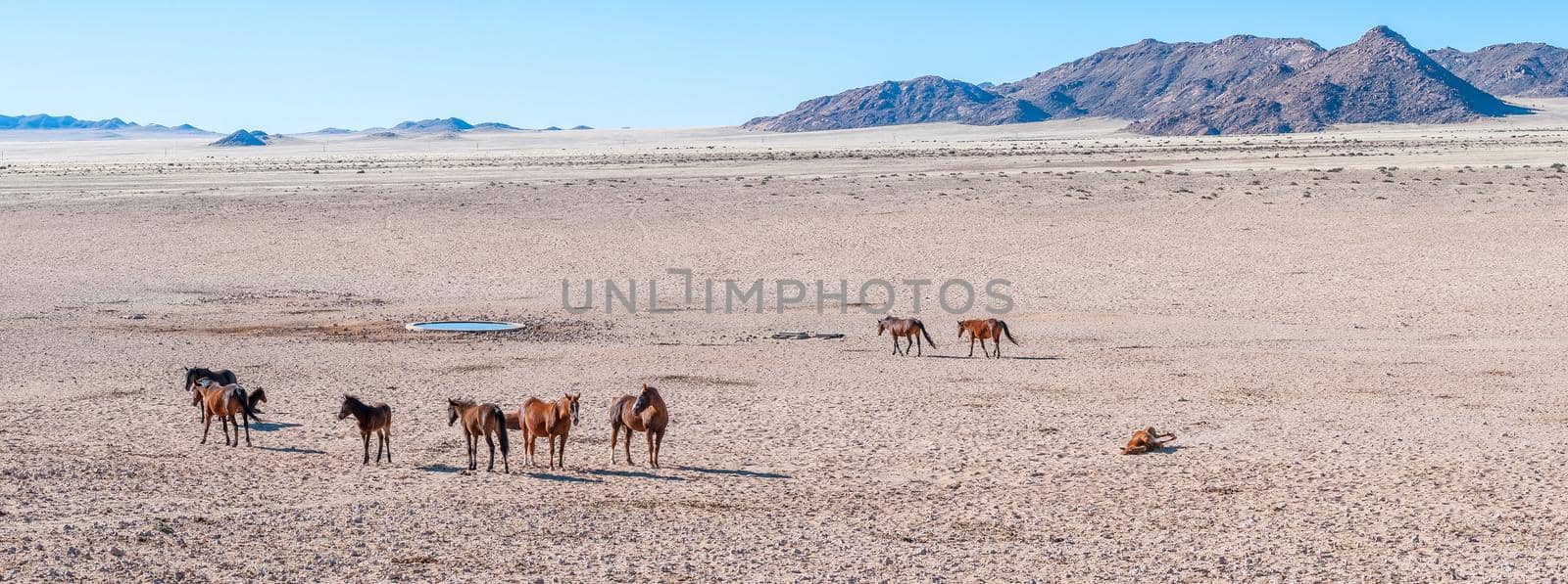
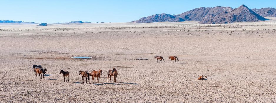
Panoramic view of wild horses of the Namib at Garub
Stock PhotoUsername
dpreezgResolution
4827x1800pxPanoramic view of wild horses of the Namib at Garub
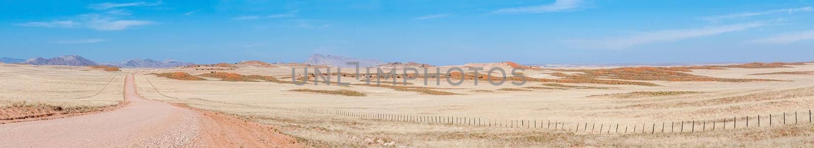
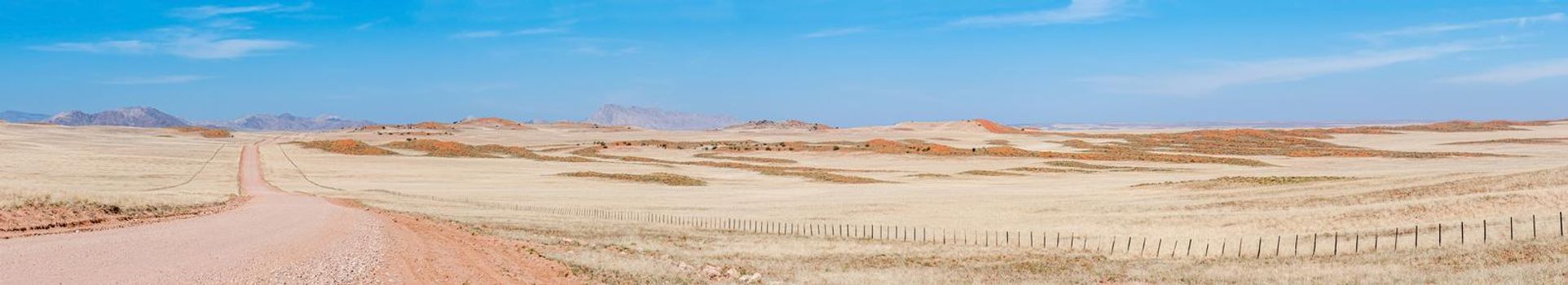
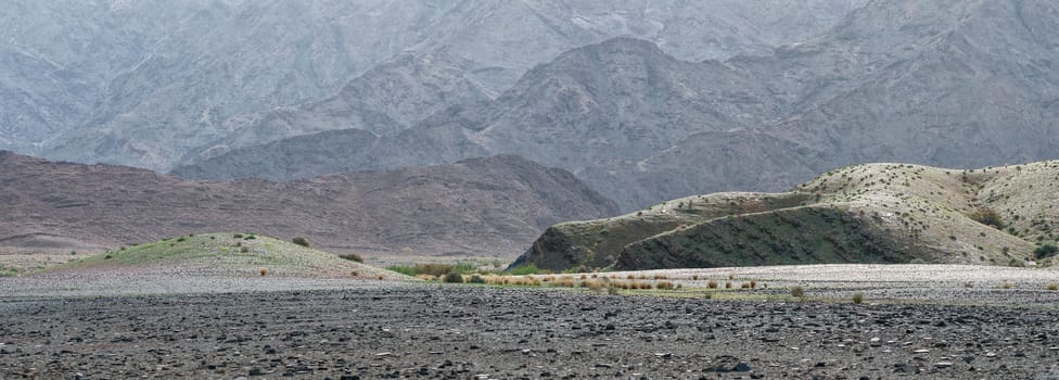
Panorama on road C14 south of the Tropic of Capricorn
Stock PhotoUsername
dpreezgResolution
9886x1800pxPanorama on road C14 south of the Tropic of Capricorn
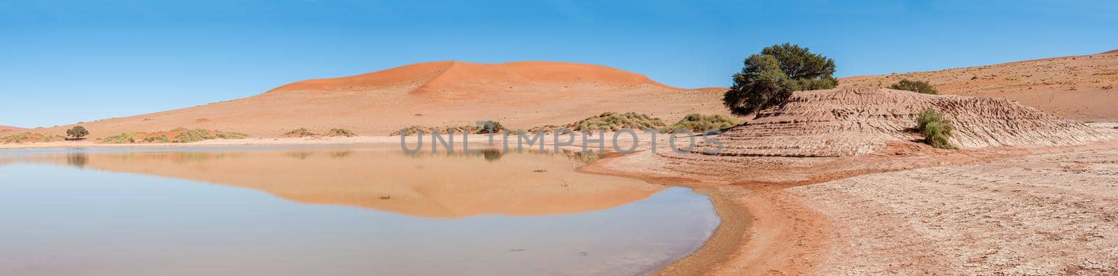
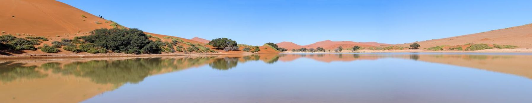
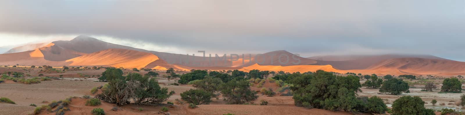
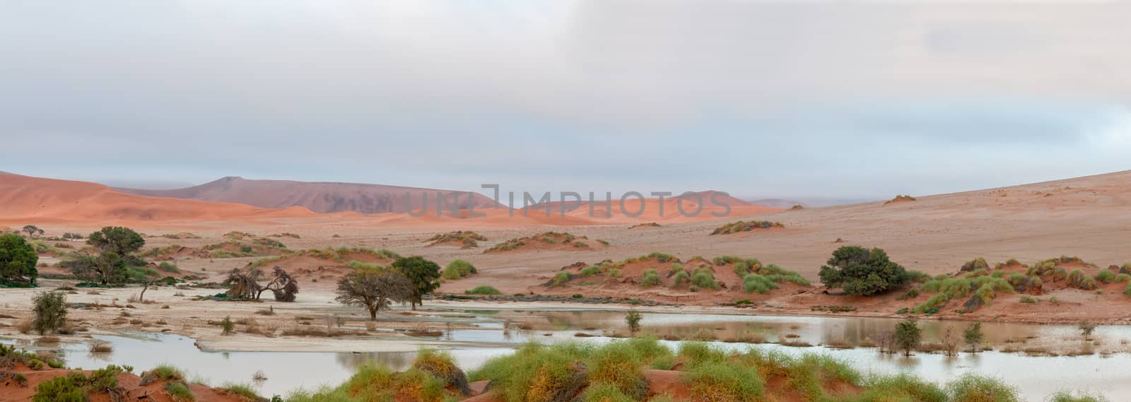
Panorama of Sossusvlei in Namibia full of water
Stock PhotoUsername
dpreezgResolution
8499x2100pxPanorama of Sossusvlei in Namibia full of water

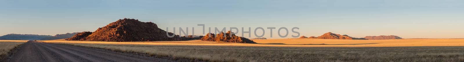
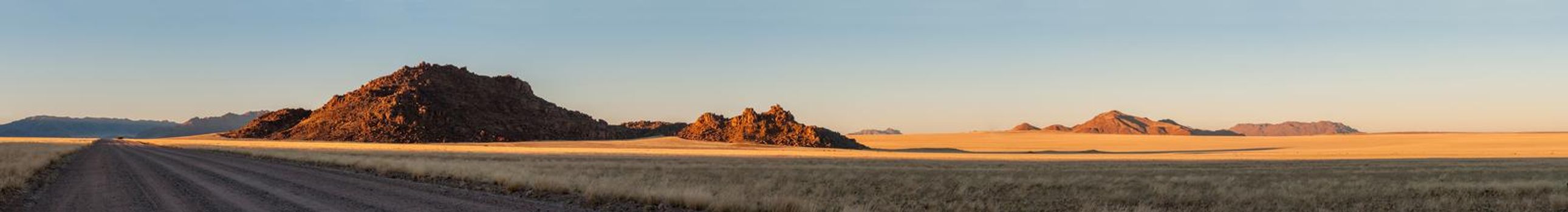
Panoramic view of the Namibrand area of Namibia
Stock PhotoUsername
dpreezgResolution
13299x1800pxPanoramic view of the Namibrand area of Namibia

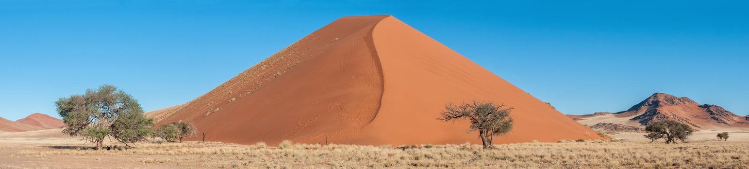
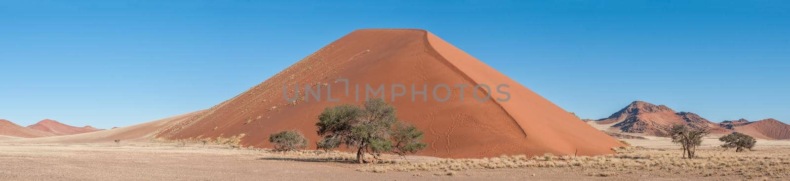
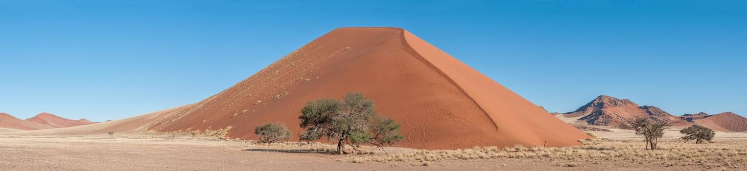
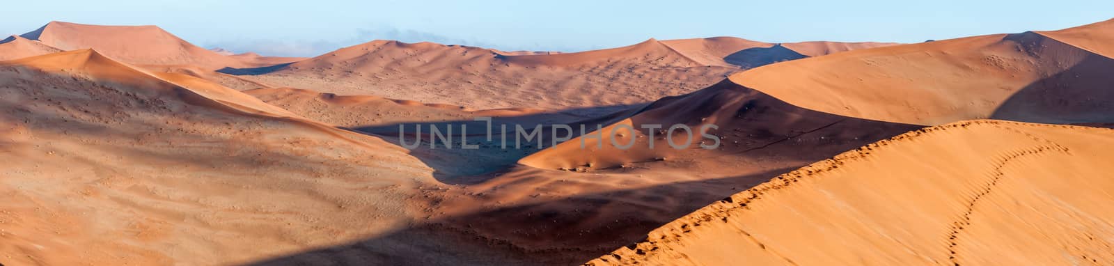
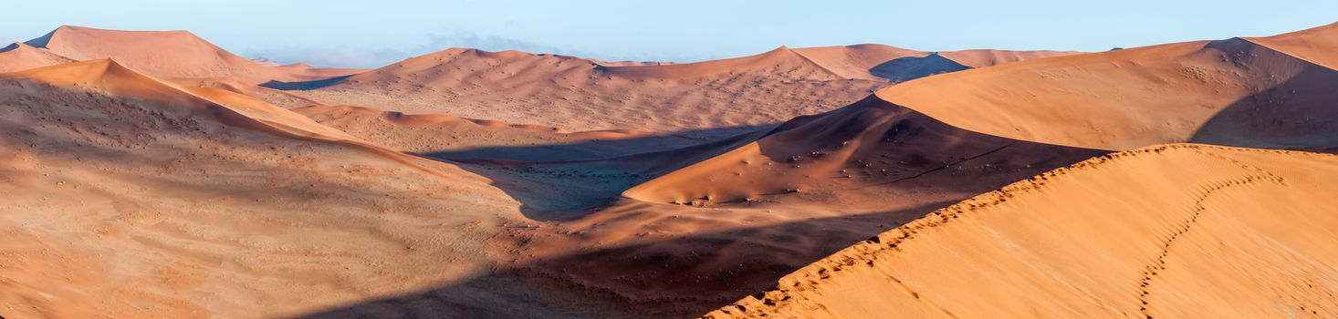
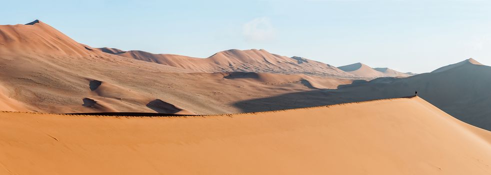
Panoramic dune landscape between Sesriem and Sossusvlei
Stock PhotoUsername
dpreezgResolution
9254x2100pxPanoramic dune landscape between Sesriem and Sossusvlei
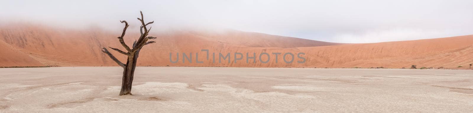
Panorama of a tree skeleton in Deadvlei near Sossusvlei
Stock PhotoUsername
dpreezgResolution
8766x2100pxPanorama of a tree skeleton in Deadvlei near Sossusvlei

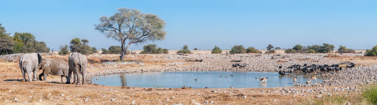
Panorama of african elephant drinking water at the Nebrownii waterhole
Stock PhotoUsername
dpreezgResolution
9692x1650pxPanorama of african elephant drinking water at the Nebrownii waterhole
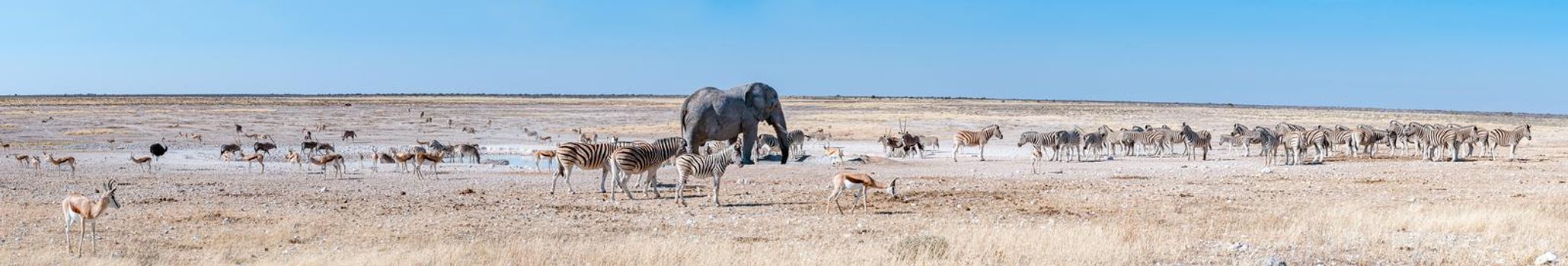
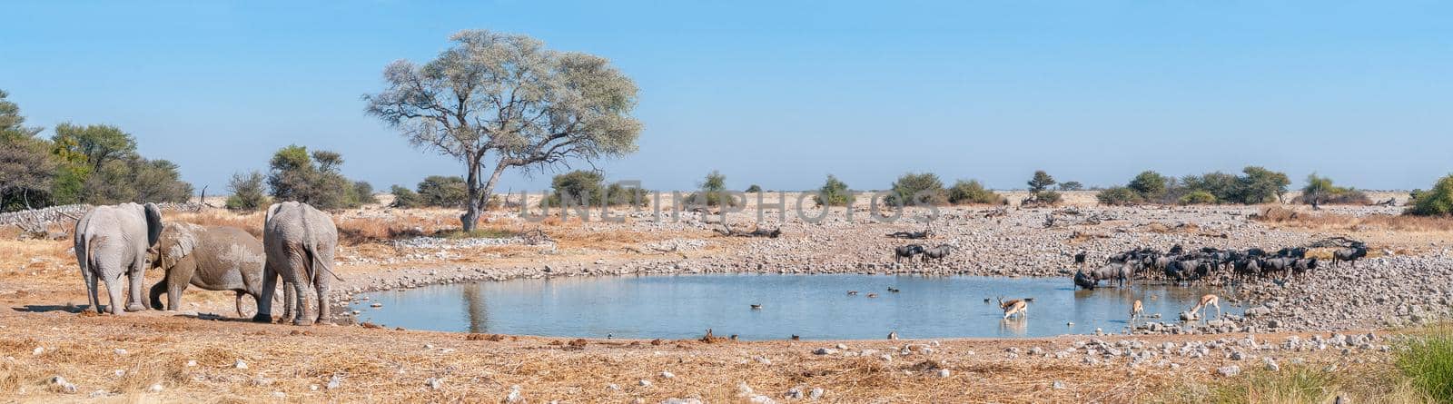
Panorama of elephants, blue wildebeest and springbok at a waterhole
Stock PhotoUsername
dpreezgResolution
7555x2100pxPanorama of elephants, blue wildebeest and springbok at a waterhole

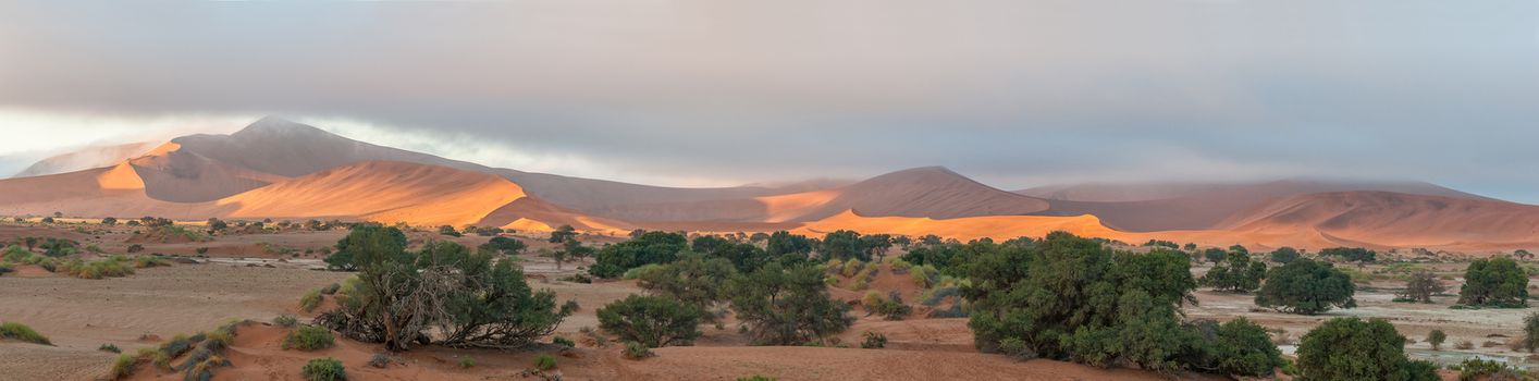
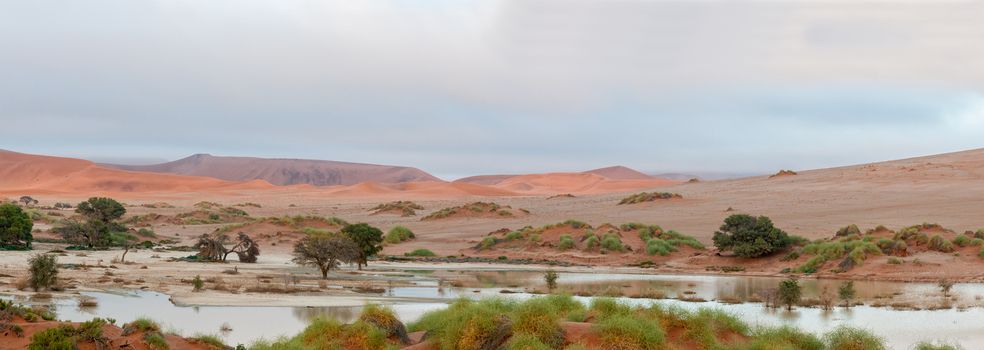
Panorama of Sossusvlei in Namibia full of water
Stock PhotoUsername
dpreezgResolution
9233x1800pxPanorama of Sossusvlei in Namibia full of water
Panoramic dune landscape between Sesriem and Sossusvlei
Stock PhotoUsername
dpreezgResolution
9164x2100pxPanoramic dune landscape between Sesriem and Sossusvlei
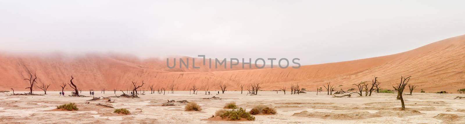
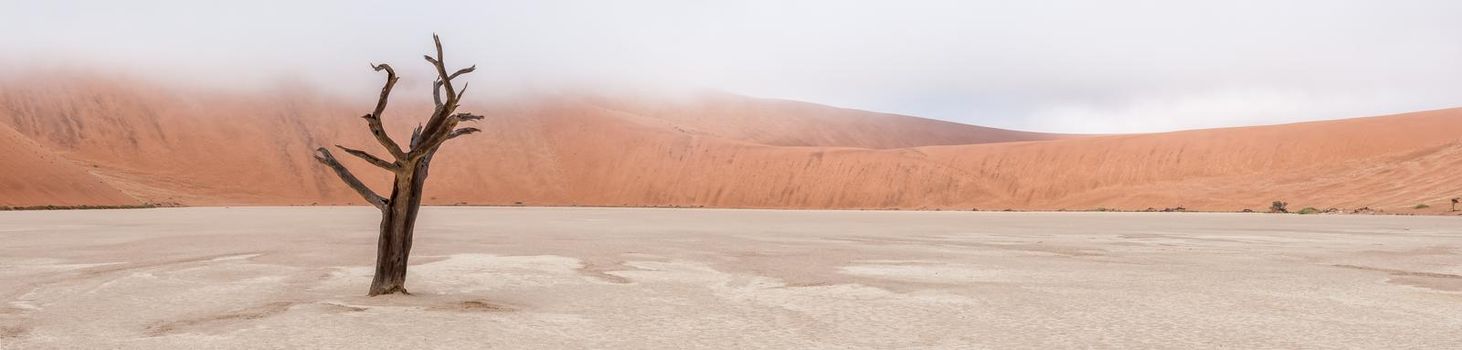
Panorama of Deadvlei near Sossusvlei in Namibia
Stock PhotoUsername
dpreezgResolution
6747x1800pxPanorama of Deadvlei near Sossusvlei in Namibia
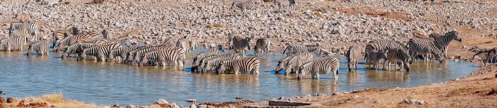
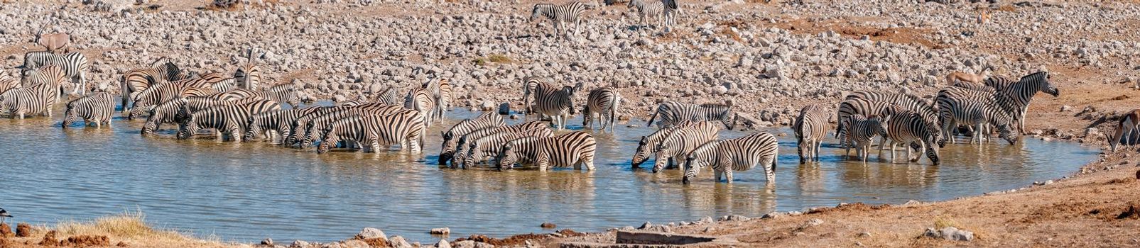
Panorama of a Burchells zebra herd drinking
Stock PhotoUsername
dpreezgResolution
7572x1650pxPanorama of a Burchells zebra herd drinking

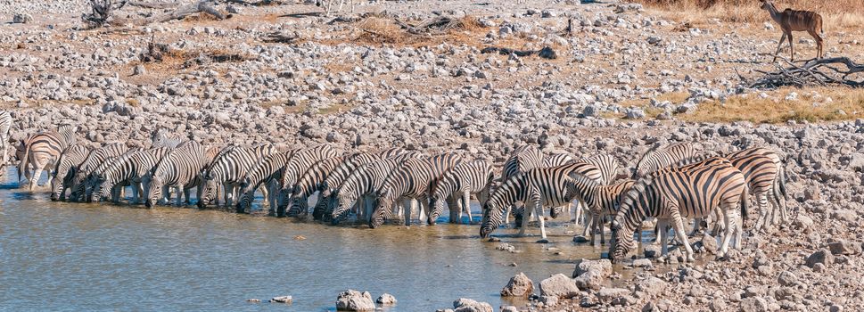
Panorama of a Burchells zebra herd drinking
Stock PhotoUsername
dpreezgResolution
5815x2100pxPanorama of a Burchells zebra herd drinking

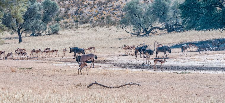
Oryx, wildebeest, springbok and ostriches in the arid Kgalagadi
Stock PhotoUsername
dpreezgResolution
3905x1800pxOryx, wildebeest, springbok and ostriches in the arid Kgalagadi
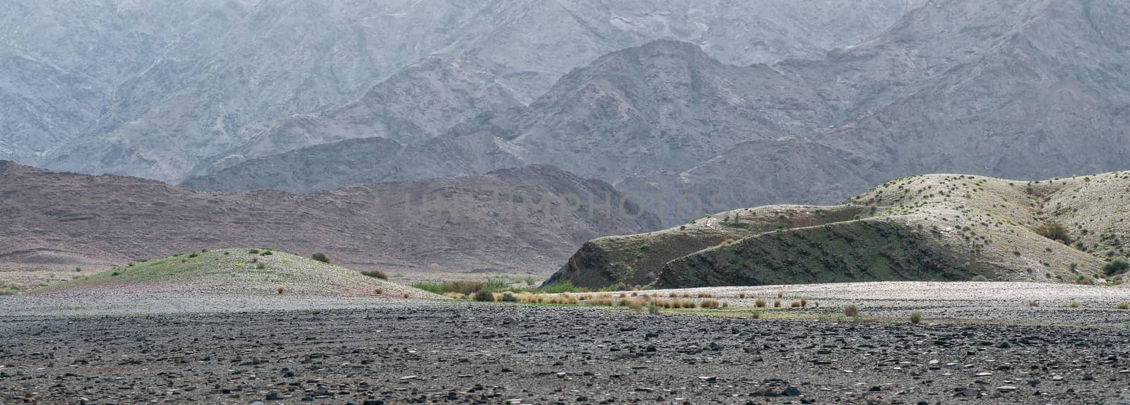
Panoramic landscape near Ai-Ais
Stock PhotoUsername
dpreezgResolution
4597x1650pxPanoramic landscape near Ai-Ais

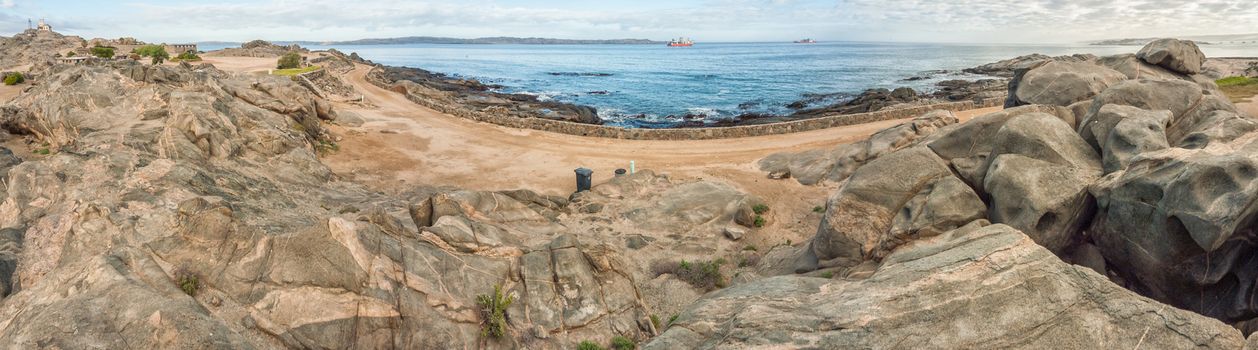
View of a camping site on Shark Island
Stock PhotoUsername
dpreezgResolution
6549x1821pxView of a camping site on Shark Island

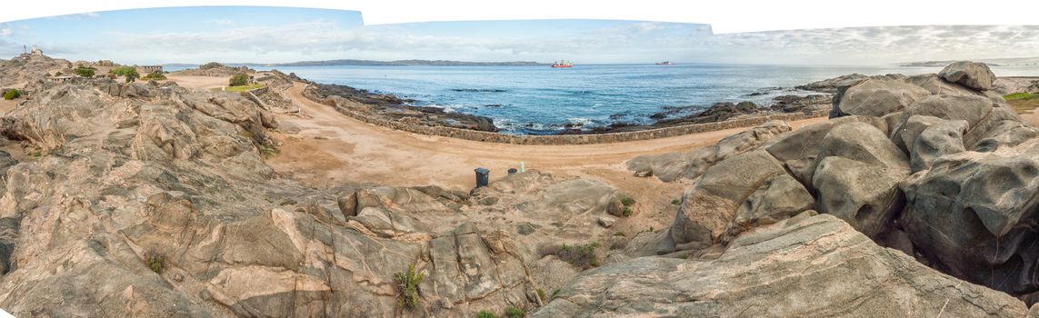
View of a camping site on Shark Island
Stock PhotoUsername
dpreezgResolution
6549x2006pxView of a camping site on Shark Island
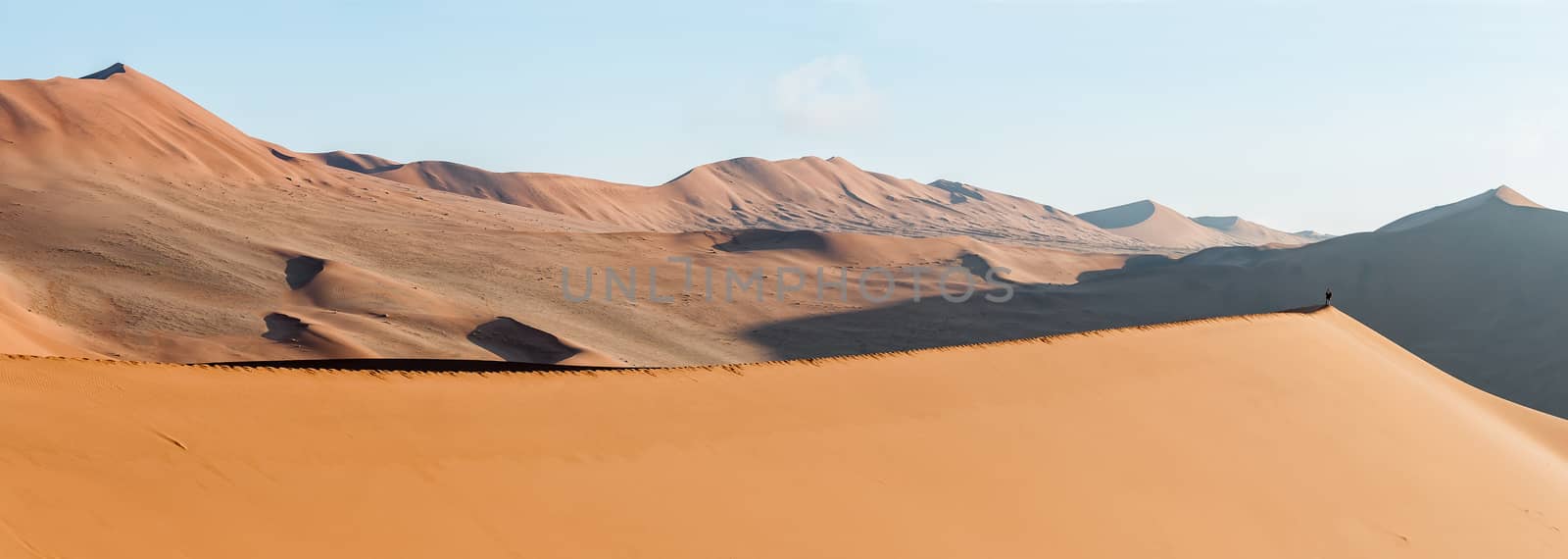
Panoramic view from sand dune at Sossusvlei towards north
Stock PhotoUsername
dpreezgResolution
7539x1800pxPanoramic view from sand dune at Sossusvlei towards north
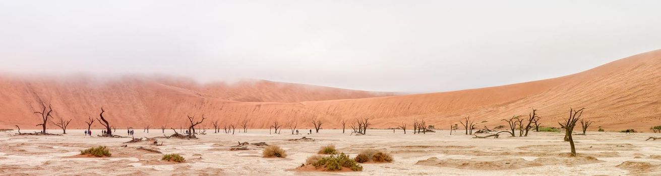
Panoramic view from Sossusvlei towards Deadvlei
Stock PhotoUsername
dpreezgResolution
6660x1650pxPanoramic view from Sossusvlei towards Deadvlei
Panoramic view from sand dune at Sossusvlei towards north-east
Stock PhotoUsername
dpreezgResolution
4632x1650pxPanoramic view from sand dune at Sossusvlei towards north-east
Panoramic view accross Sossusvlei to the south-west
Stock PhotoUsername
dpreezgResolution
5062x1800pxPanoramic view accross Sossusvlei to the south-west
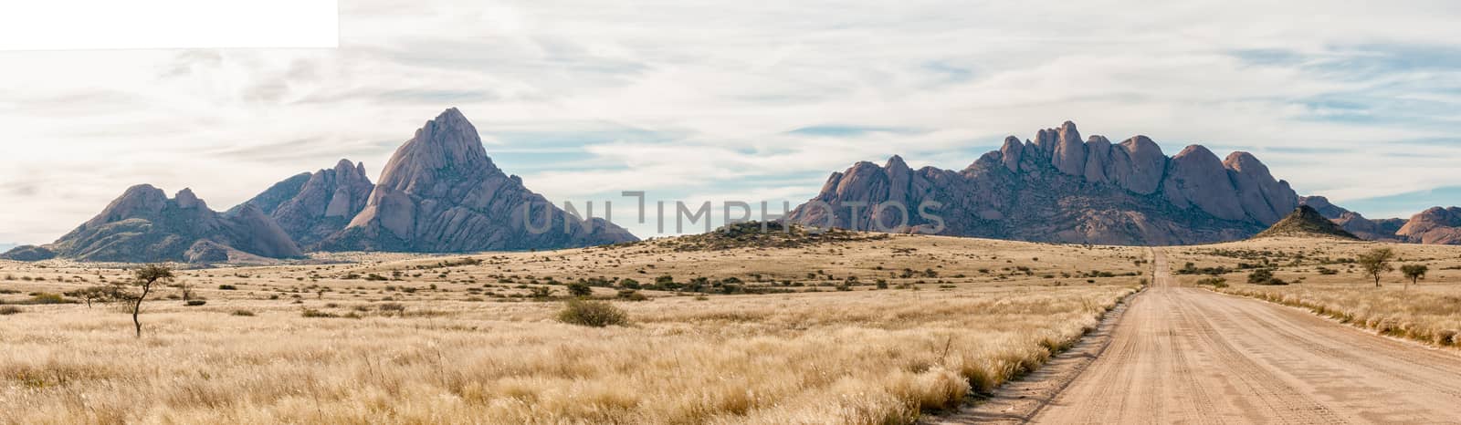
Panorama of Spitzkoppe and Pondok mountains seen from road D3716
Stock PhotoUsername
dpreezgResolution
6179x1800pxPanorama of Spitzkoppe and Pondok mountains seen from road D3716


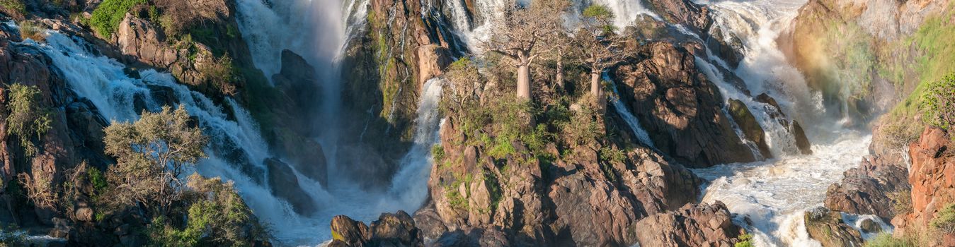
Stitched panorama of part of the Epupa waterfalls
Stock PhotoUsername
dpreezgResolution
6932x1800pxStitched panorama of part of the Epupa waterfalls
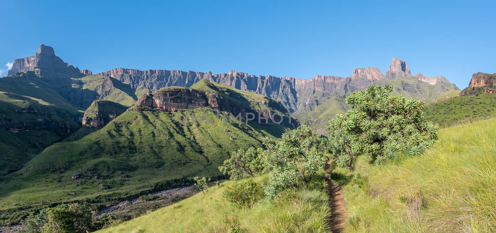
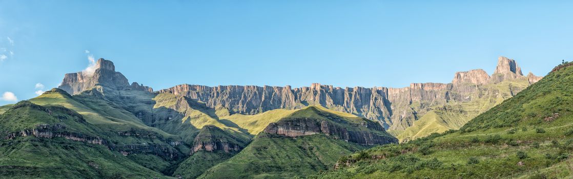
Panoramic view from Tugela Gorge hiking trail towards the Amphit
Stock PhotoUsername
dpreezgResolution
3818x1800pxPanoramic view from Tugela Gorge hiking trail towards the Amphit
View of Uithoek with zip lines visible
Stock PhotoUsername
dpreezgResolution
6399x1800pxView of Uithoek with zip lines visible


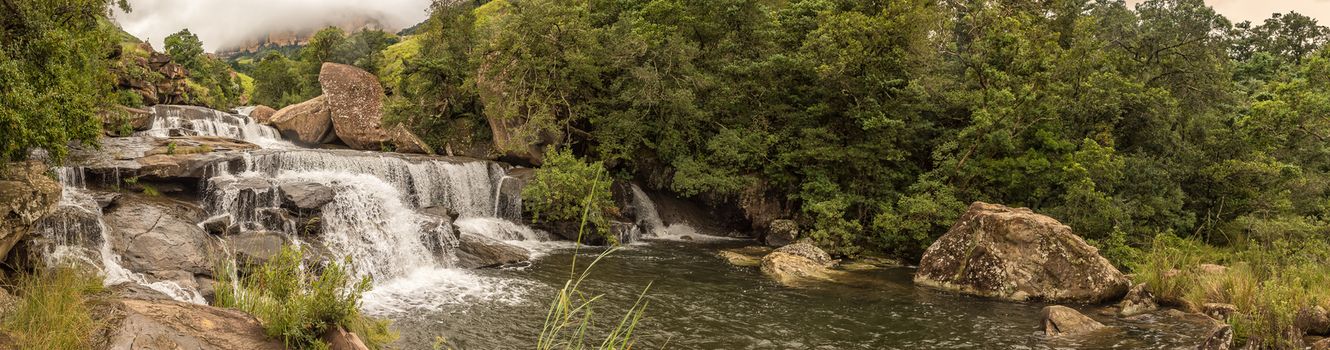
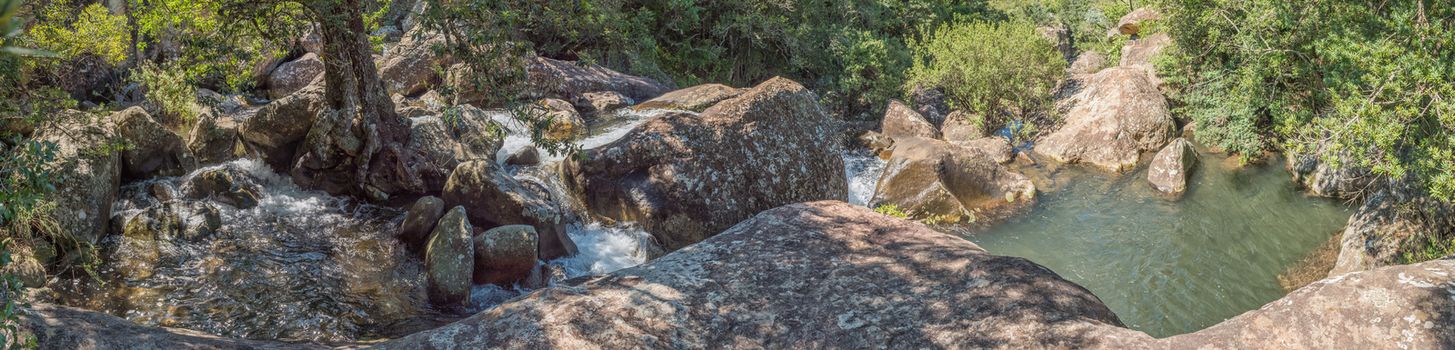
Panorama of the Cascades in Mahai River after heavy rains
Stock PhotoUsername
dpreezgResolution
6266x1650pxPanorama of the Cascades in Mahai River after heavy rains
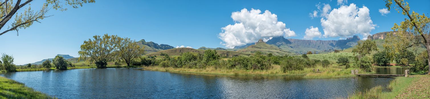
Trout dam with Amphitheatre, Dooley Hills and Ploughmans Kop vis
Stock PhotoUsername
dpreezgResolution
6892x2100pxTrout dam with Amphitheatre, Dooley Hills and Ploughmans Kop vis

Trout dam with Amphitheatre visible in the back
Stock PhotoUsername
dpreezgResolution
9058x2100pxTrout dam with Amphitheatre visible in the back
Trout pools on road to start of Tugela Gorge trail
Stock PhotoUsername
dpreezgResolution
5444x2400pxTrout pools on road to start of Tugela Gorge trail
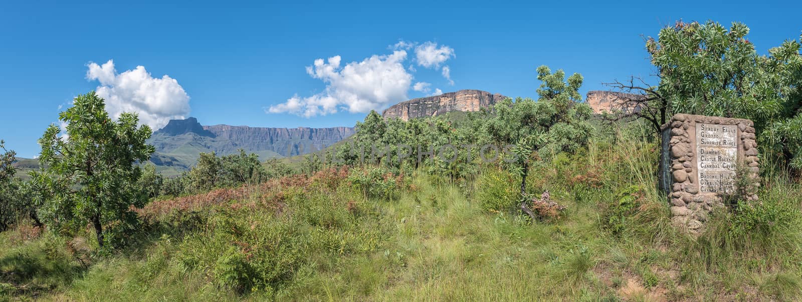
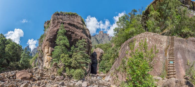
Sign on a hiking trail on slope of Ploughmans Kop
Stock PhotoUsername
dpreezgResolution
5572x2100pxSign on a hiking trail on slope of Ploughmans Kop


180 degree panorama of the view from Lookout Rock
Stock PhotoUsername
dpreezgResolution
10832x1800px180 degree panorama of the view from Lookout Rock

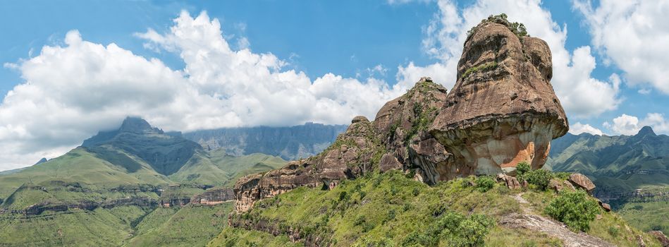
Panoramic view of the Policemans Helmet
Stock PhotoUsername
dpreezgResolution
6513x2400pxPanoramic view of the Policemans Helmet
Panoramic view from the hiking trail to the Policemans Helmet
Stock PhotoUsername
dpreezgResolution
13819x2100pxPanoramic view from the hiking trail to the Policemans Helmet

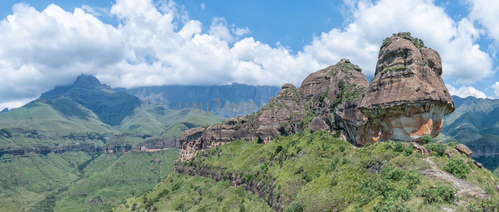
Panoramic view of the Policemans Helmet
Stock PhotoUsername
dpreezgResolution
4932x2100pxPanoramic view of the Policemans Helmet


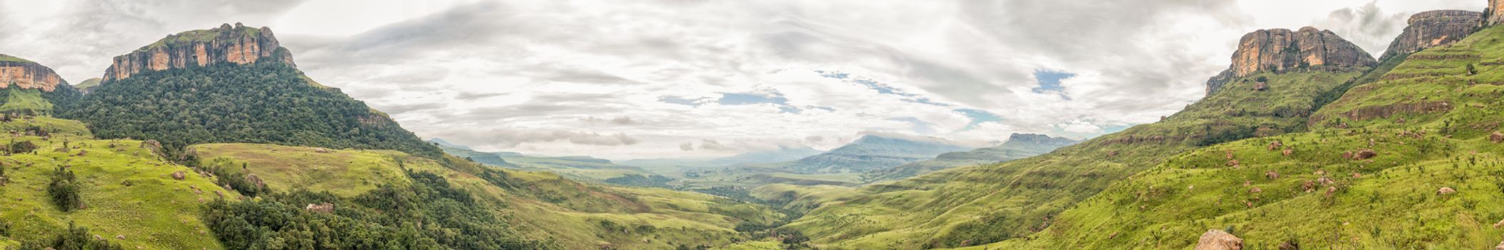
Panoramic view of the Tugela Gorge towards the South
Stock PhotoUsername
dpreezgResolution
6051x2700pxPanoramic view of the Tugela Gorge towards the South
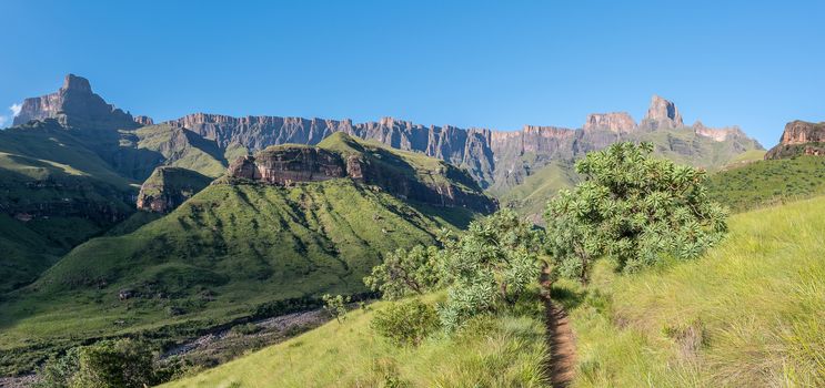
Panoramic view from Tugela Gorge hiking trail towards the Amphit
Stock PhotoUsername
dpreezgResolution
7660x2400pxPanoramic view from Tugela Gorge hiking trail towards the Amphit

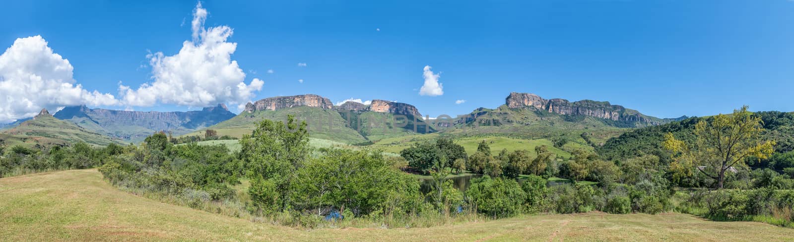
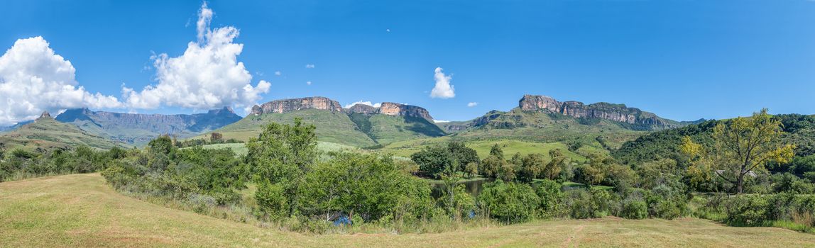
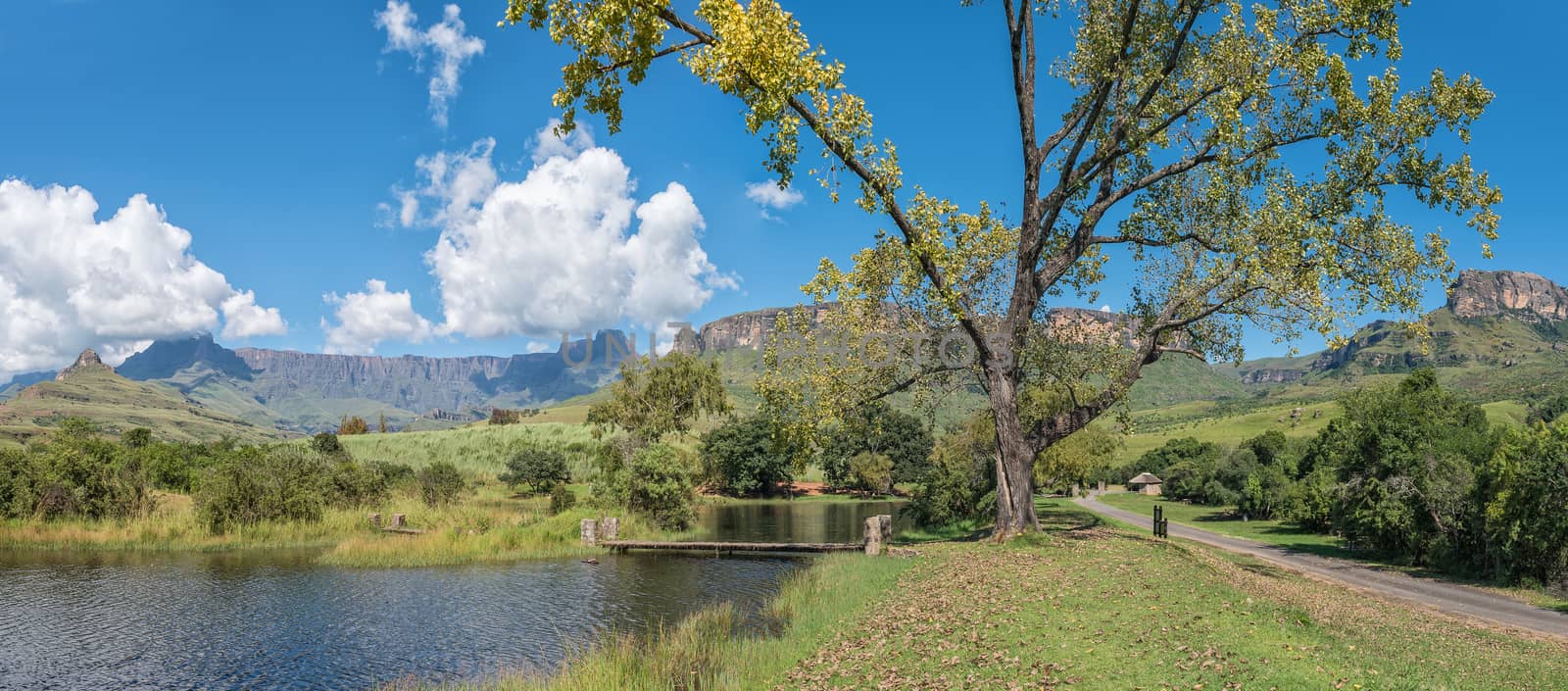
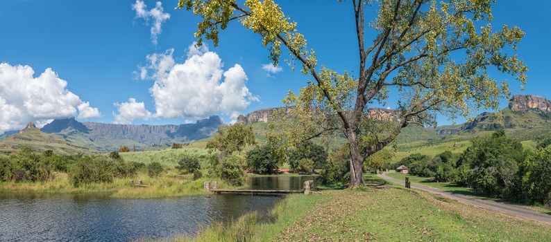
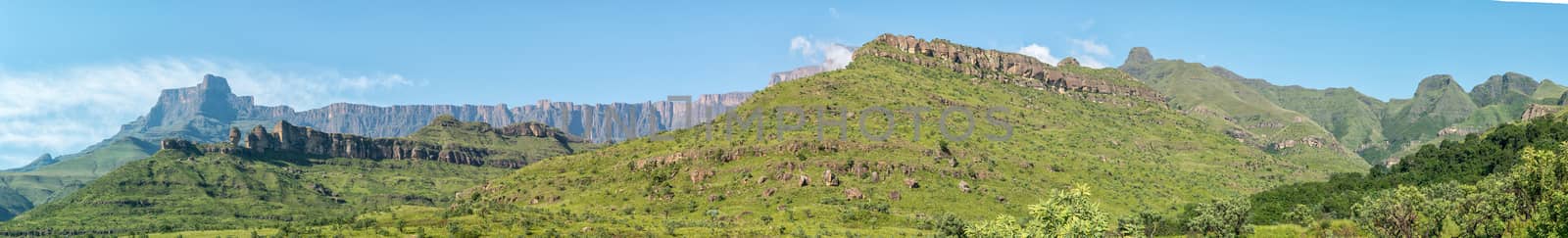
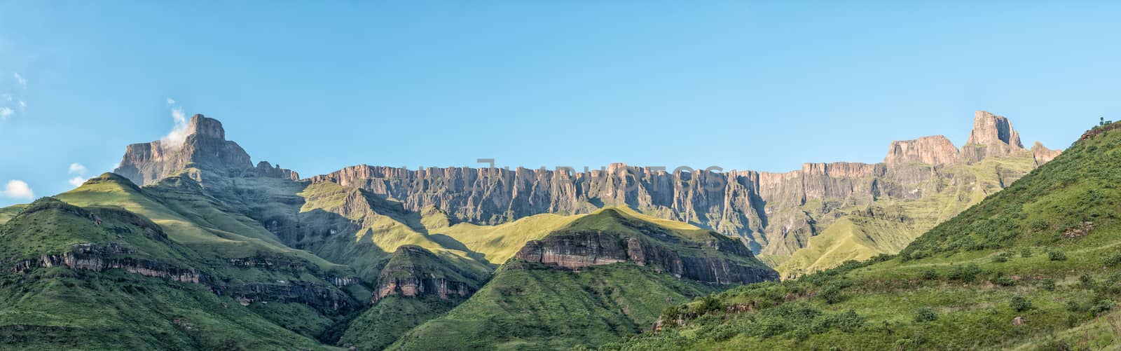
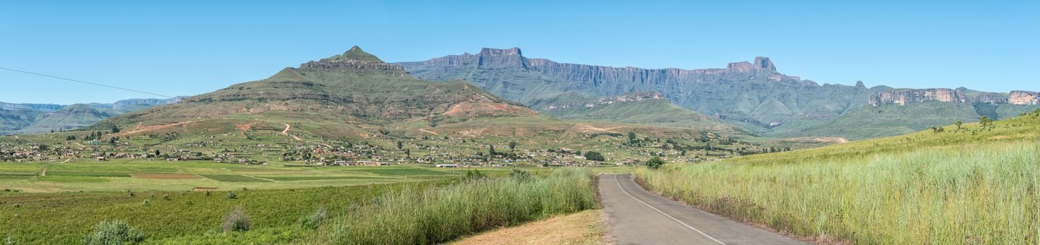
Panoramic view of the Northern Drakensberg
Stock PhotoUsername
dpreezgResolution
7472x2100pxPanoramic view of the Northern Drakensberg
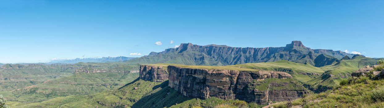

View of the Amphitheatre with Bonjaneni township in the front
Stock PhotoUsername
dpreezgResolution
8888x2100pxView of the Amphitheatre with Bonjaneni township in the front
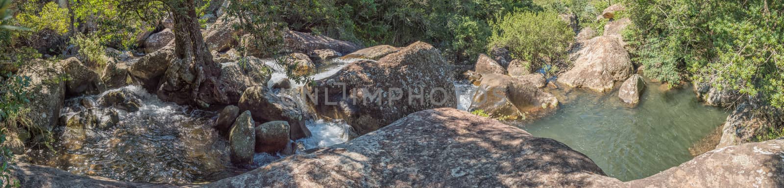
Panorama of the Mahai River at McKinleys Pool
Stock PhotoUsername
dpreezgResolution
9973x2400pxPanorama of the Mahai River at McKinleys Pool
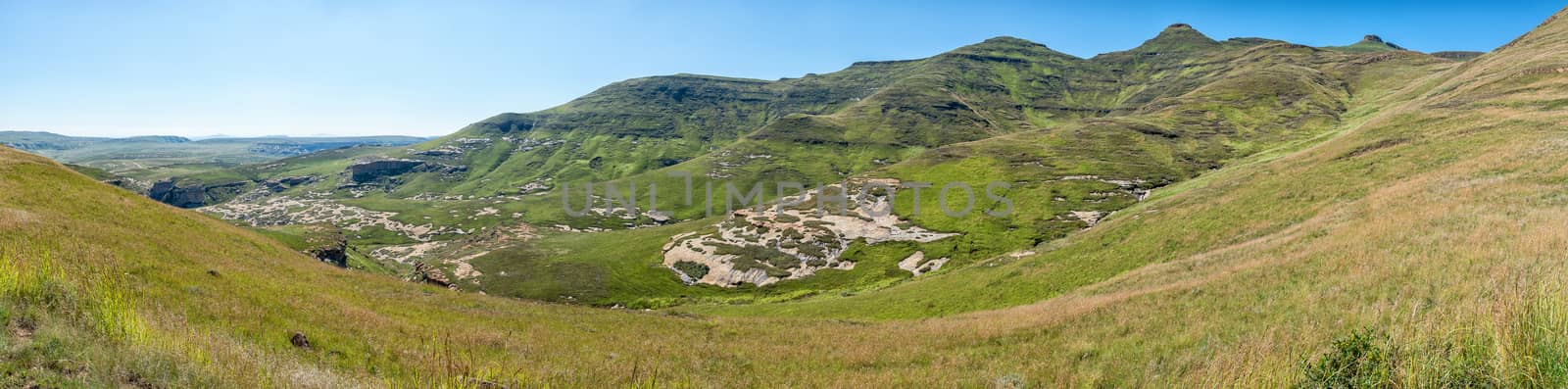
Panoramic view from Generaalskop Viewpoint in Golden Gate
Stock PhotoUsername
dpreezgResolution
8059x2000pxPanoramic view from Generaalskop Viewpoint in Golden Gate
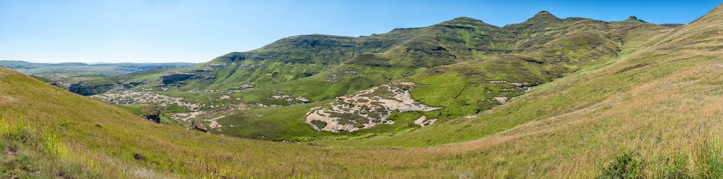

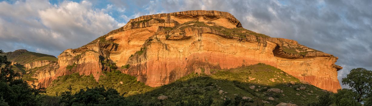
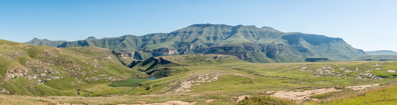
Panorama of the Golden Gate area
Stock PhotoUsername
dpreezgResolution
7940x2100pxPanorama of the Golden Gate area

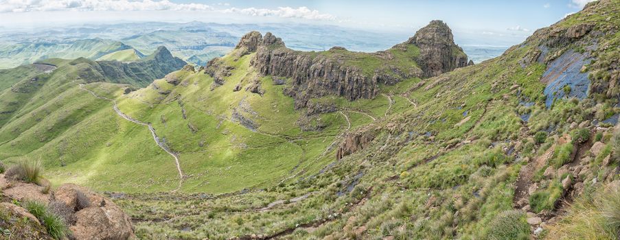
Panorama of the first part of the Sentinel hiking trail
Stock PhotoUsername
dpreezgResolution
5415x2100pxPanorama of the first part of the Sentinel hiking trail

Panoramic view of the Mushroom Rocks at sunset
Stock PhotoUsername
dpreezgResolution
6314x1800pxPanoramic view of the Mushroom Rocks at sunset