- Filter By:
-
-
Stock photos and images of username:RnDmS
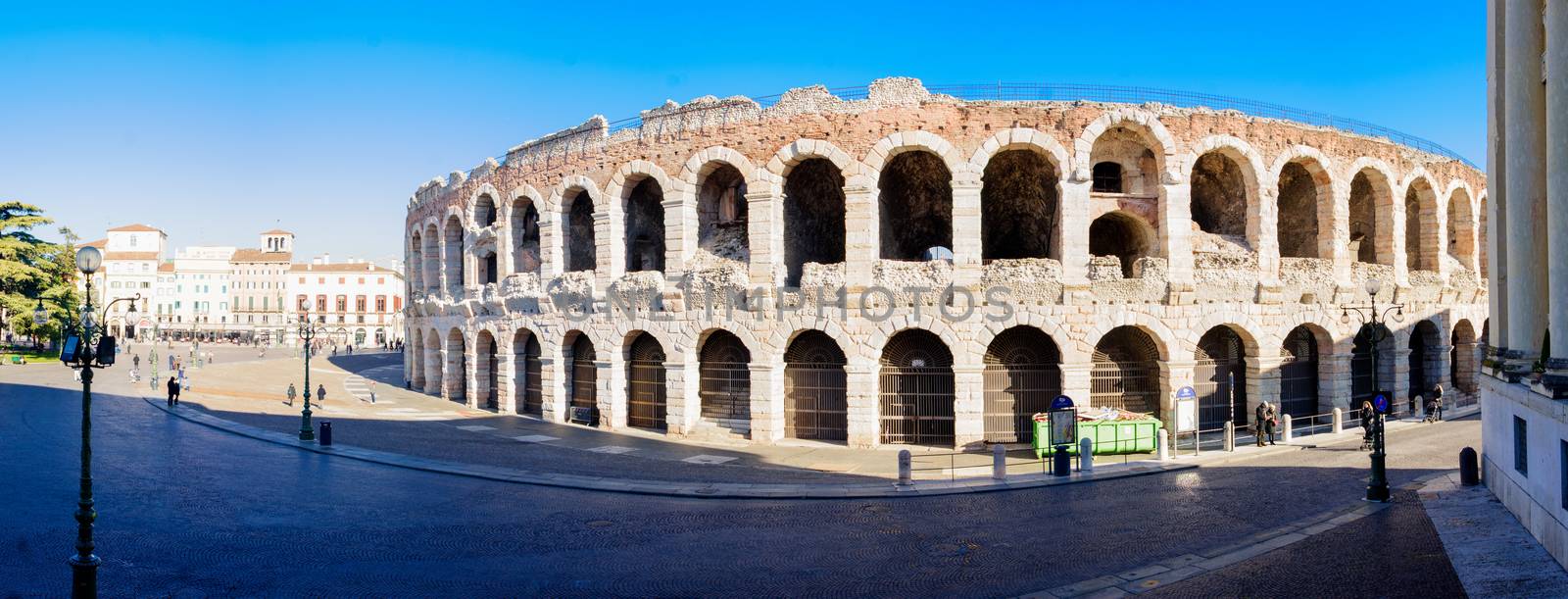
Arena, Verona
Editorial LicenseUsername
RnDmSResolution
9422x3598pxArena, Verona

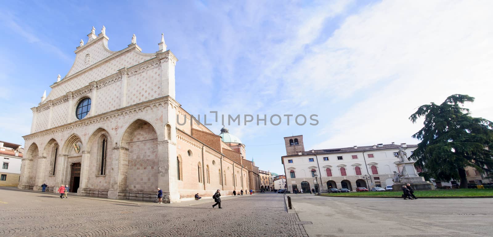
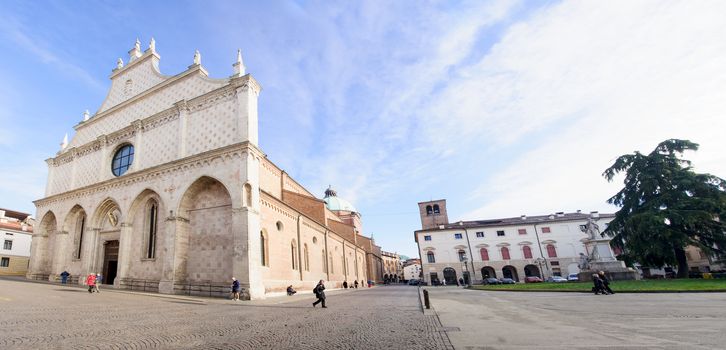
Duomo, Vicenza
Editorial LicenseUsername
RnDmSResolution
8524x4106pxDuomo, Vicenza
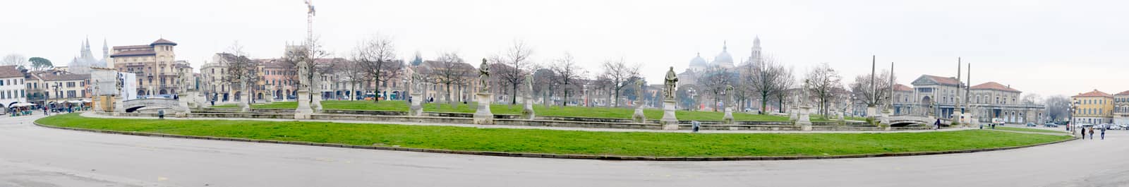
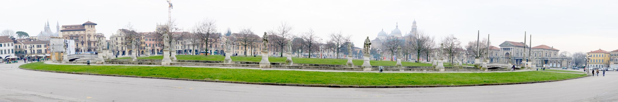
Piazza Prato della Valle, Padua
Editorial LicenseUsername
RnDmSResolution
14546x2406pxPiazza Prato della Valle, Padua
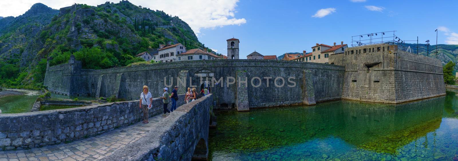
North Gate, Kotor
Editorial LicenseUsername
RnDmSResolution
9985x3505pxNorth Gate, Kotor

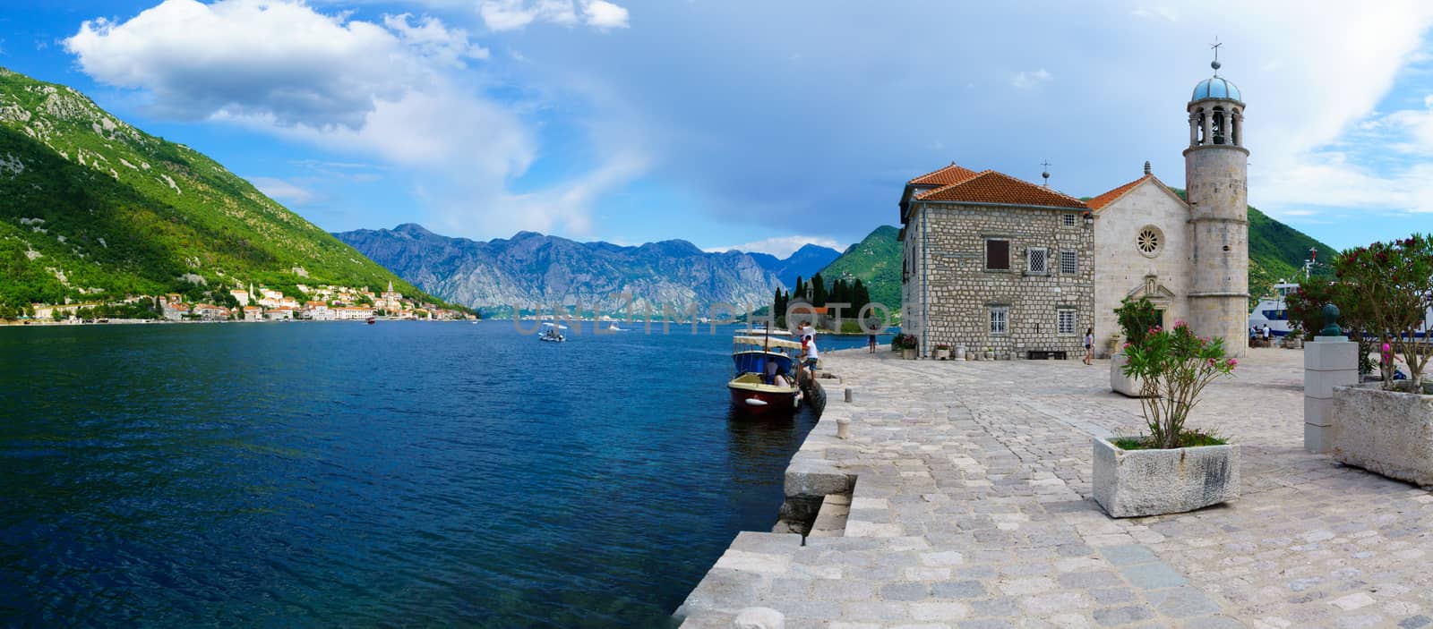
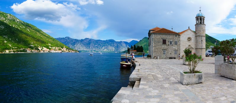
Our Lady of the Rocks church
Editorial LicenseUsername
RnDmSResolution
8925x3921pxOur Lady of the Rocks church
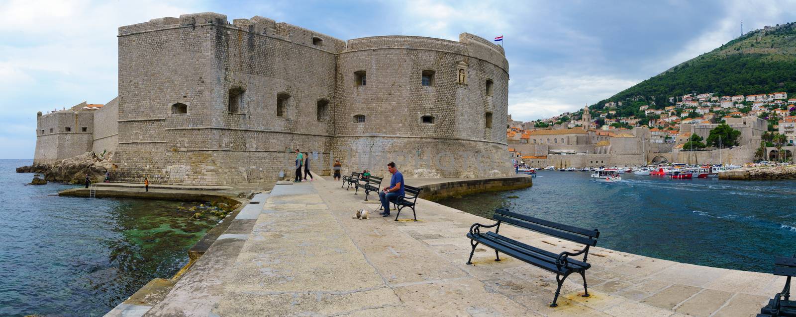
Porporela, Dubrovnik
Editorial LicenseUsername
RnDmSResolution
9358x3740pxPorporela, Dubrovnik
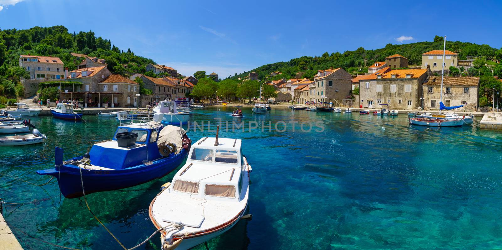
Sudurad Fishing Port
Editorial LicenseUsername
RnDmSResolution
8377x4177pxSudurad Fishing Port


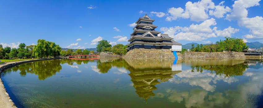
Panoramic view of Matsumoto Castle (Crow Castle) and bridge
Editorial LicenseUsername
RnDmSResolution
9218x3796pxPanoramic view of Matsumoto Castle (Crow Castle) and bridge
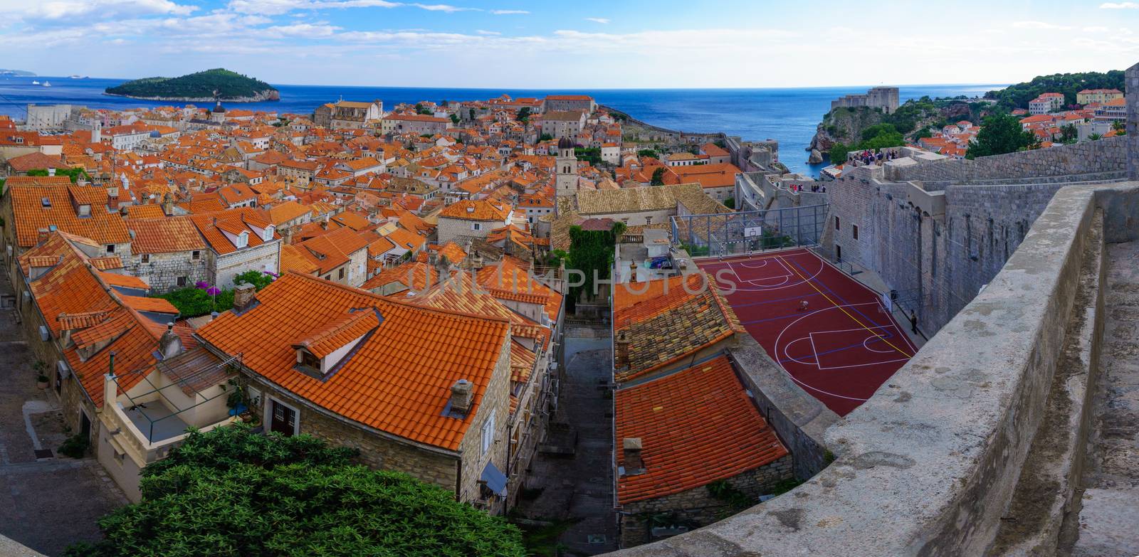
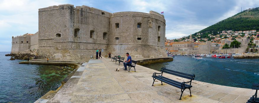
Old City Panorama, Dubrovnik
Editorial LicenseUsername
RnDmSResolution
8000x3916pxOld City Panorama, Dubrovnik

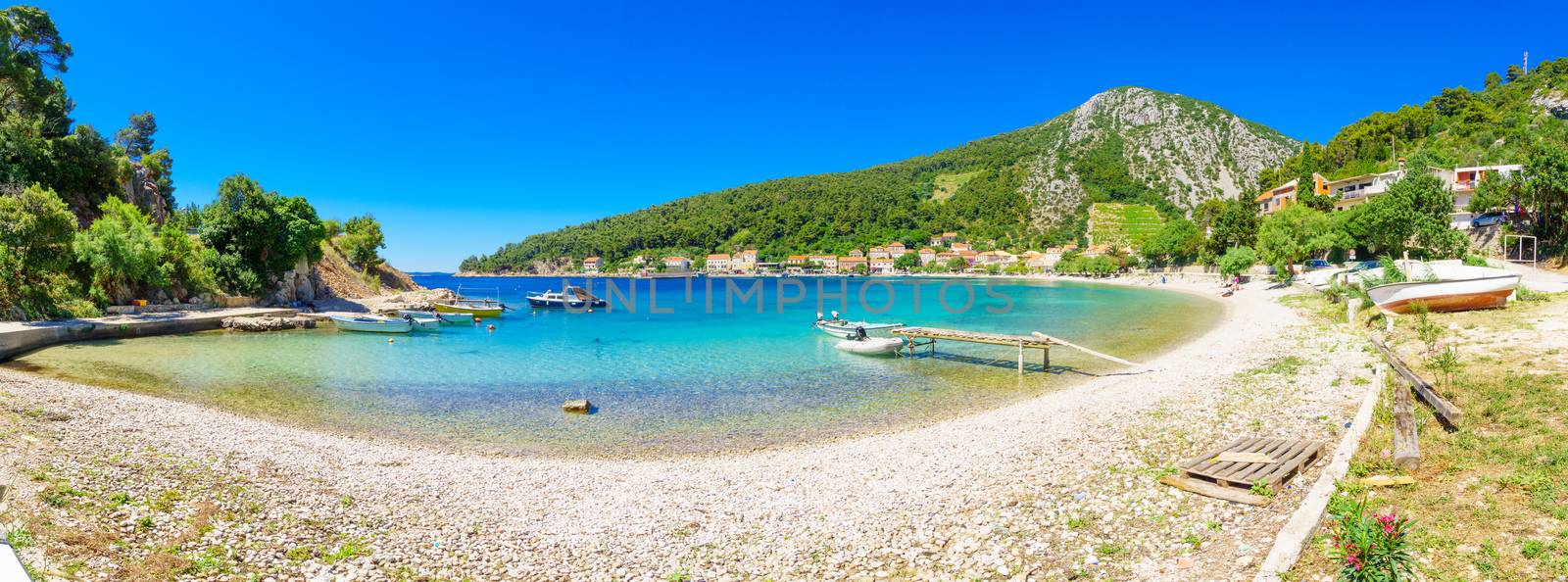
The bay of Trstenik
Editorial LicenseUsername
RnDmSResolution
9707x3606pxThe bay of Trstenik


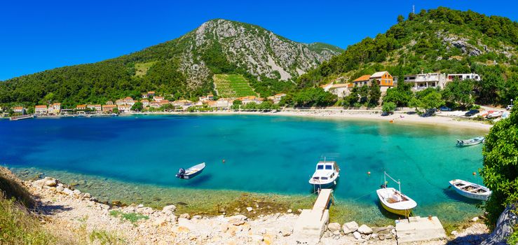
The bay of Trstenik
Editorial LicenseUsername
RnDmSResolution
8592x4072pxThe bay of Trstenik

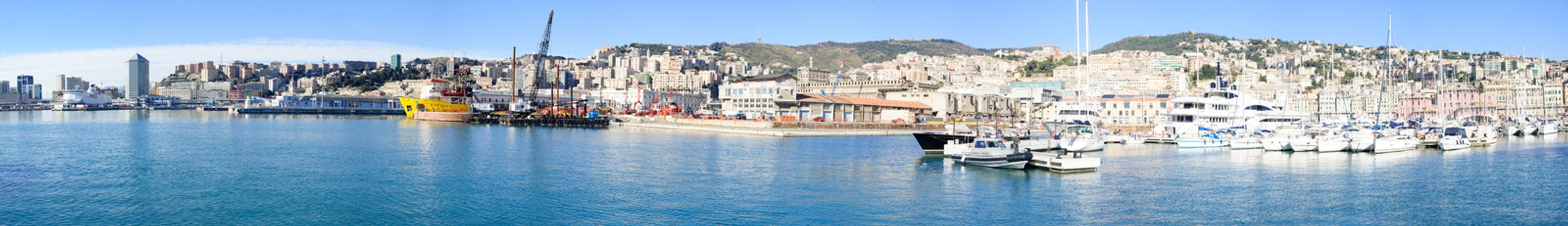
Old port, Genoa
Editorial LicenseUsername
RnDmSResolution
15552x2250pxOld port, Genoa

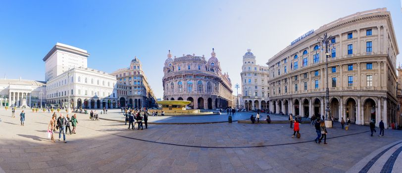
Piazza de Ferrari, Genoa
Editorial LicenseUsername
RnDmSResolution
8300x3580pxPiazza de Ferrari, Genoa
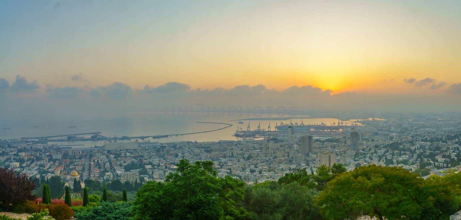
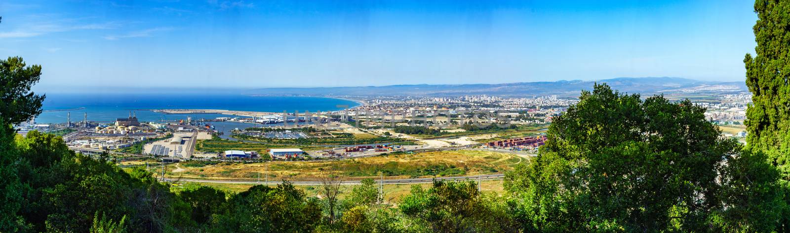
Sunrise panorama of downtown Haifa, the port, and the bay
Stock PhotoUsername
RnDmSResolution
7267x3477pxSunrise panorama of downtown Haifa, the port, and the bay


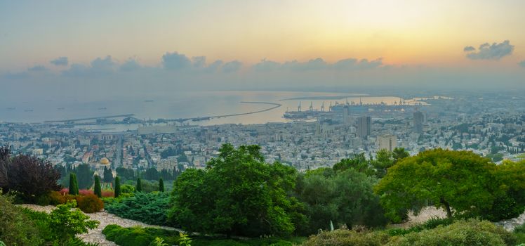
Sunrise panorama of downtown Haifa, the port, and the bay
Stock PhotoUsername
RnDmSResolution
7358x3443pxSunrise panorama of downtown Haifa, the port, and the bay
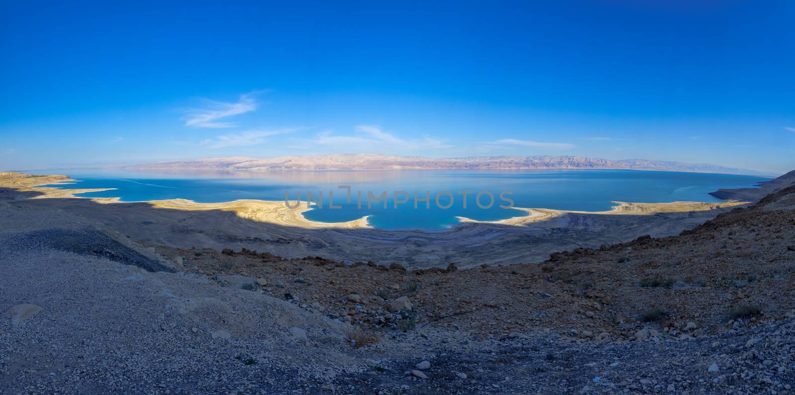
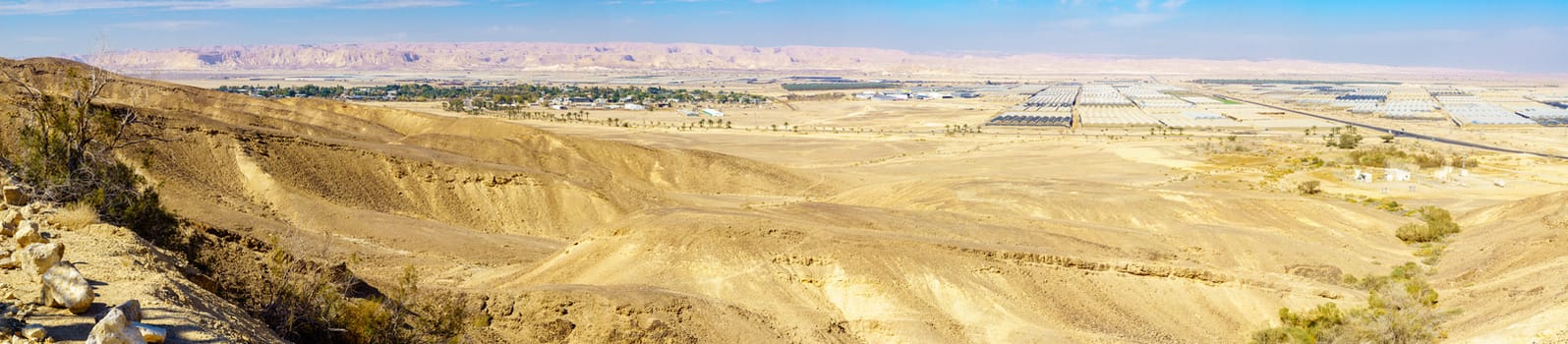
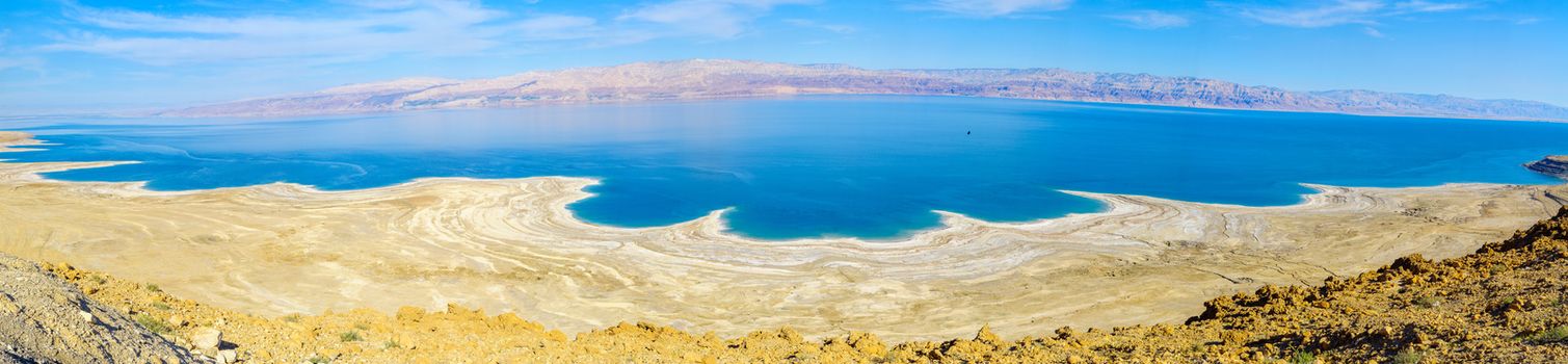
Panoramic landscape of the coastline of the Dead Sea
Stock PhotoUsername
RnDmSResolution
7246x3601pxPanoramic landscape of the coastline of the Dead Sea
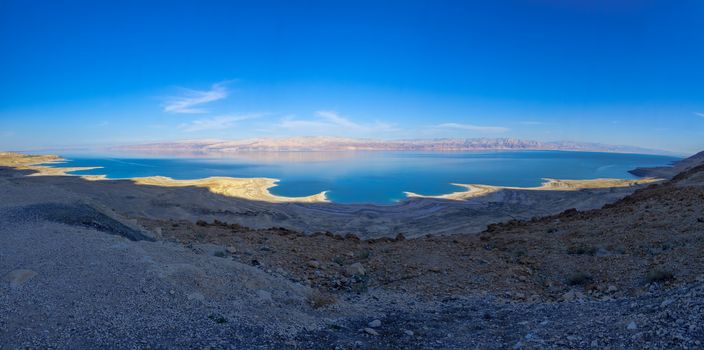

Panoramic landscape of the coastline of the Dead Sea
Stock PhotoUsername
RnDmSResolution
8836x3961pxPanoramic landscape of the coastline of the Dead Sea
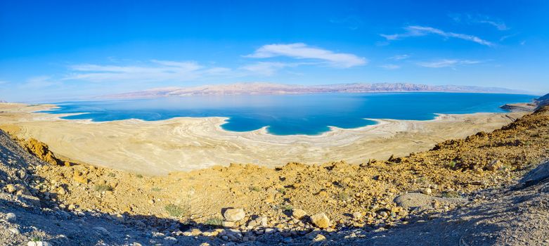

Panoramic landscape of the coastline of the Dead Sea
Stock PhotoUsername
RnDmSResolution
12285x2849pxPanoramic landscape of the coastline of the Dead Sea
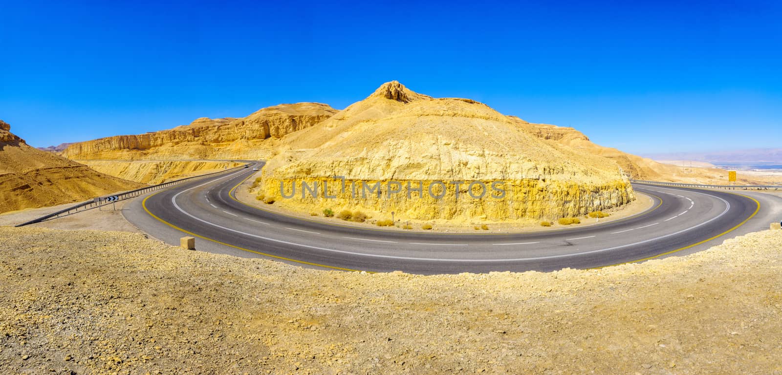
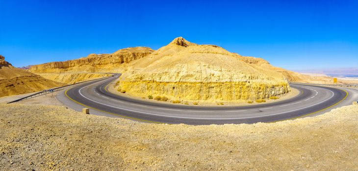
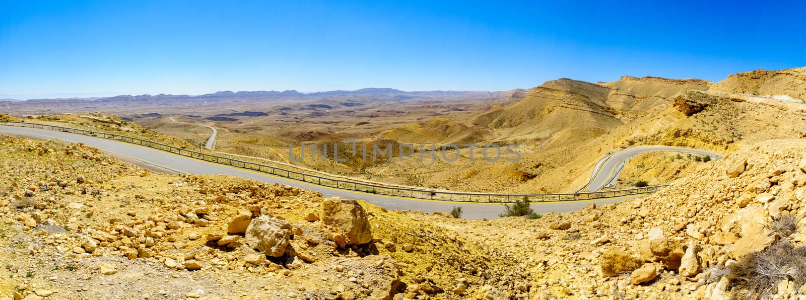
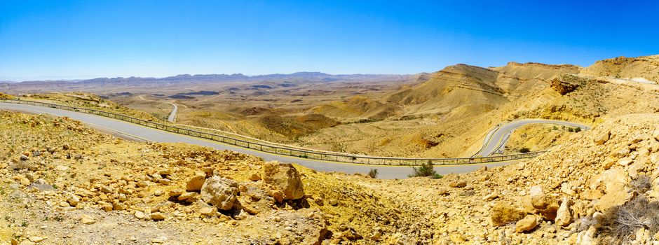
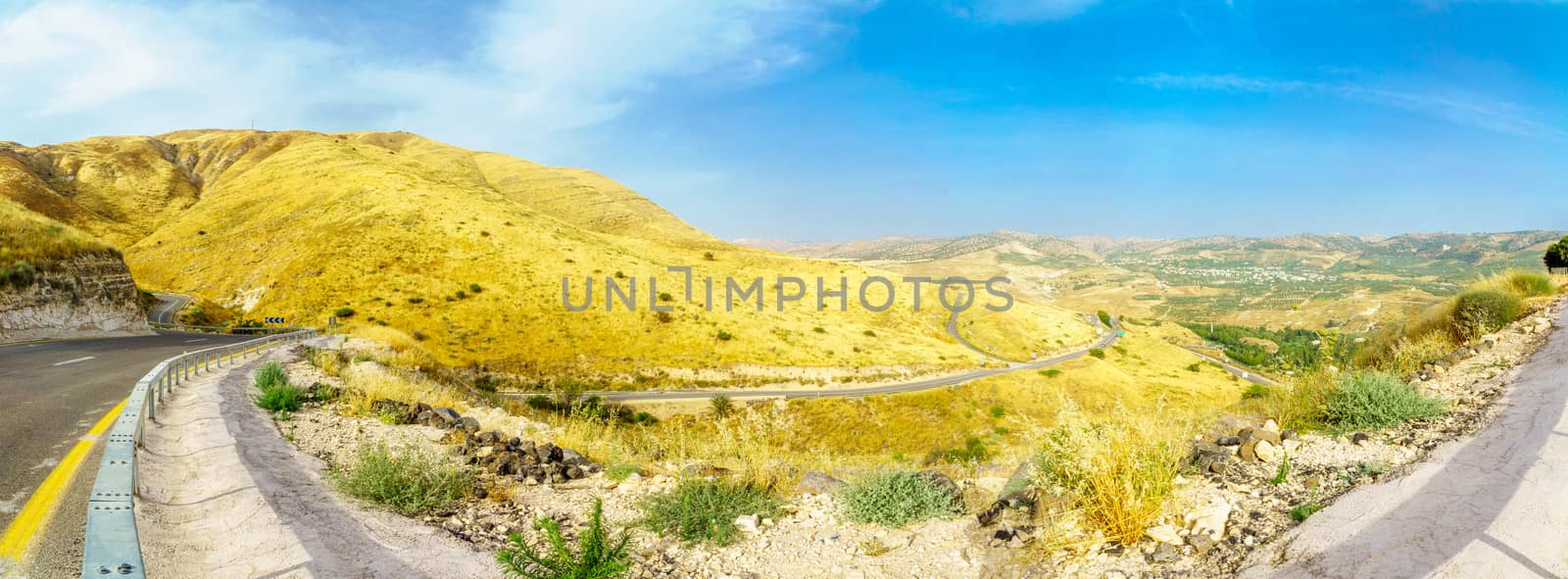
Winding desert road
Stock PhotoUsername
RnDmSResolution
8544x4096pxWinding desert road

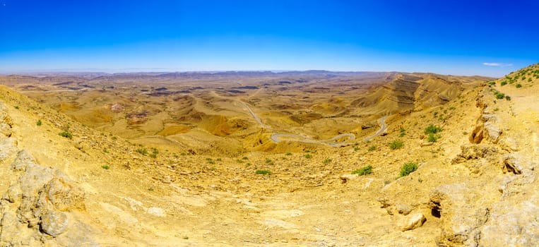
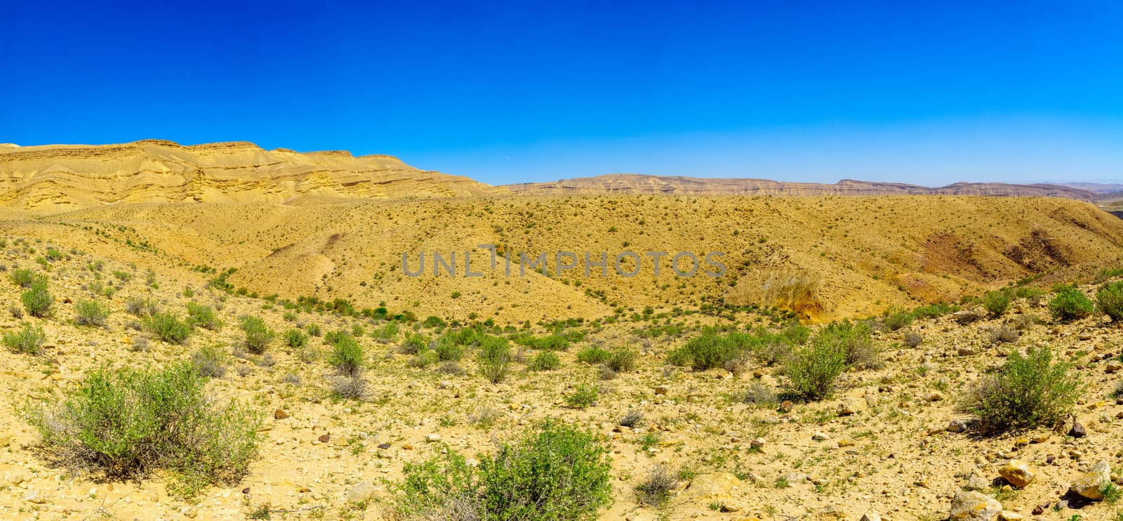
Landscape of HaMakhtesh HaGadol
Stock PhotoUsername
RnDmSResolution
8733x4007pxLandscape of HaMakhtesh HaGadol

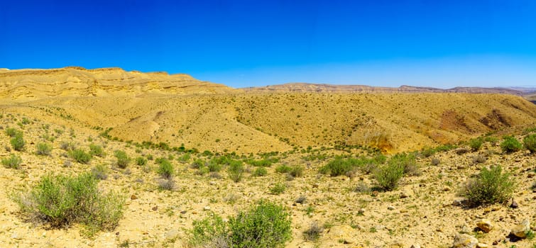
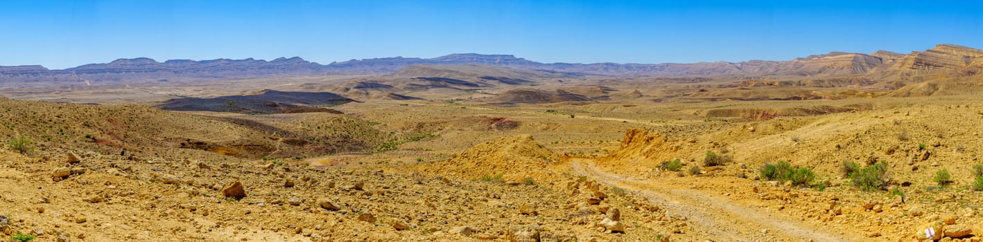
Panoramic landscape of HaMakhtesh HaGadol
Stock PhotoUsername
RnDmSResolution
10693x3273pxPanoramic landscape of HaMakhtesh HaGadol
Landscape of HaMakhtesh HaGadol
Stock PhotoUsername
RnDmSResolution
9692x3611pxLandscape of HaMakhtesh HaGadol
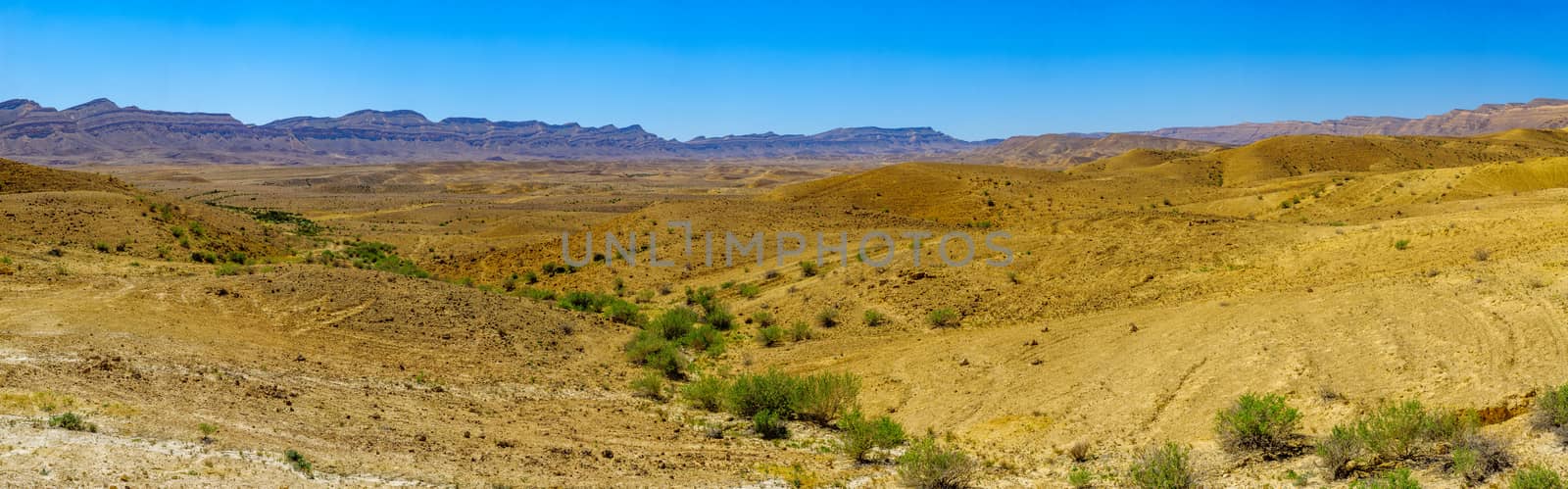
Panoramic landscape of HaMakhtesh HaGadol
Stock PhotoUsername
RnDmSResolution
8689x4027pxPanoramic landscape of HaMakhtesh HaGadol

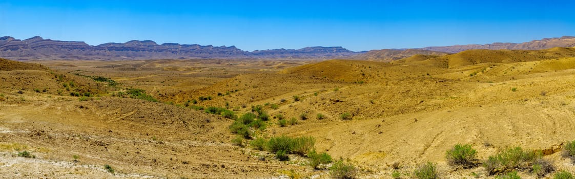
Panoramic landscape of HaMakhtesh HaGadol
Stock PhotoUsername
RnDmSResolution
11910x2938pxPanoramic landscape of HaMakhtesh HaGadol
Panoramic landscape of HaMakhtesh HaGadol
Stock PhotoUsername
RnDmSResolution
10588x3305pxPanoramic landscape of HaMakhtesh HaGadol

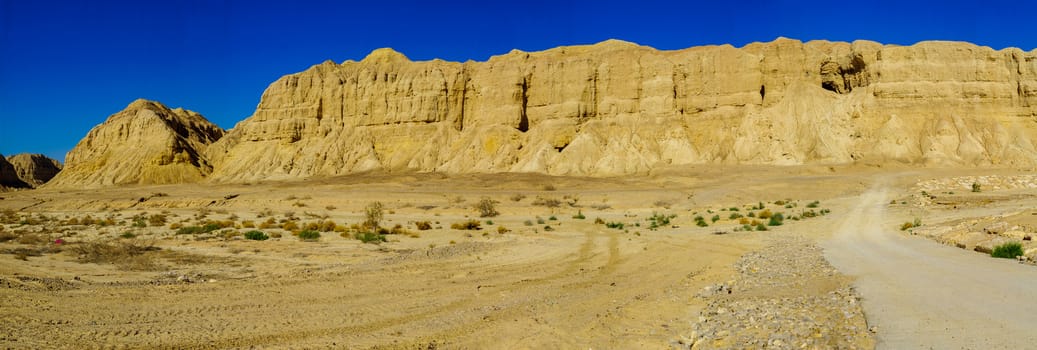
Panoramic landscape and Marlstone rock formation
Stock PhotoUsername
RnDmSResolution
10185x3436pxPanoramic landscape and Marlstone rock formation
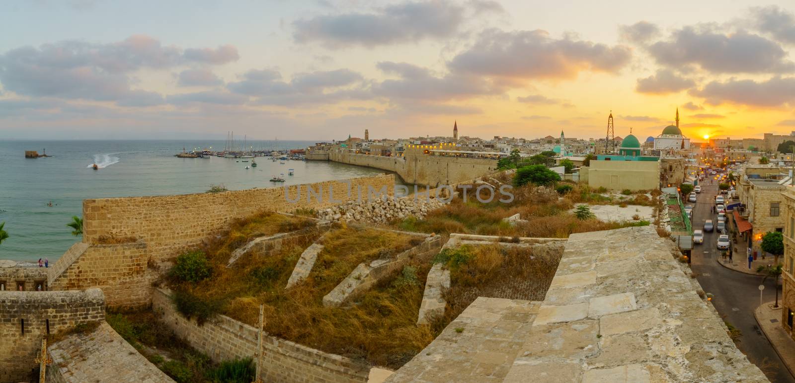
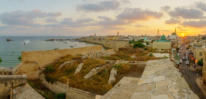
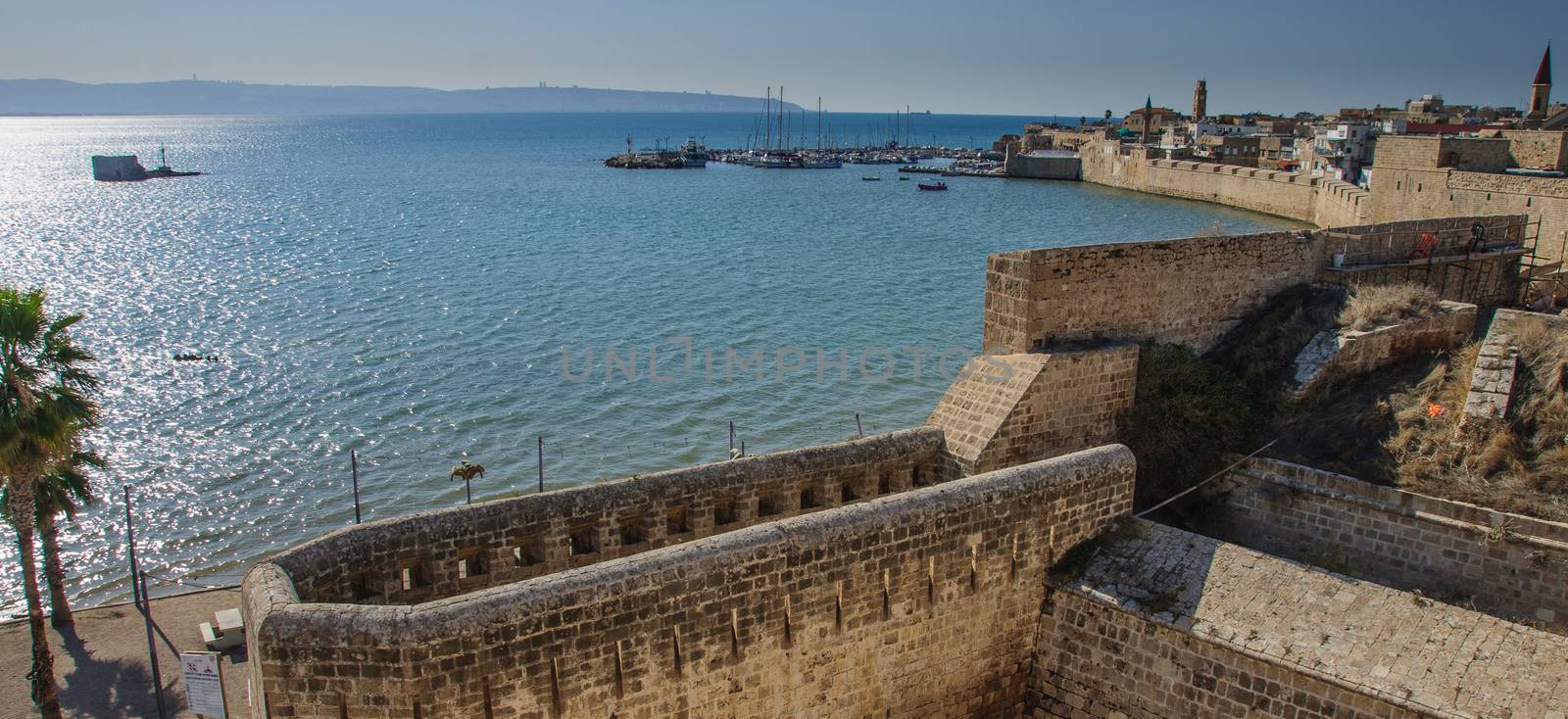
Panoramic sunset view with skyline, walls and port, Acre
Stock PhotoUsername
RnDmSResolution
5723x2759pxPanoramic sunset view with skyline, walls and port, Acre
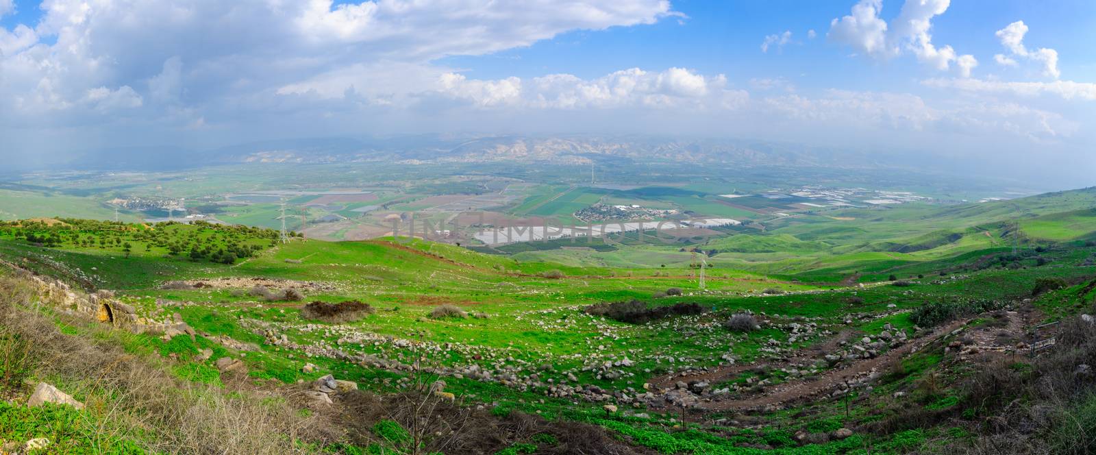
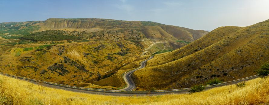
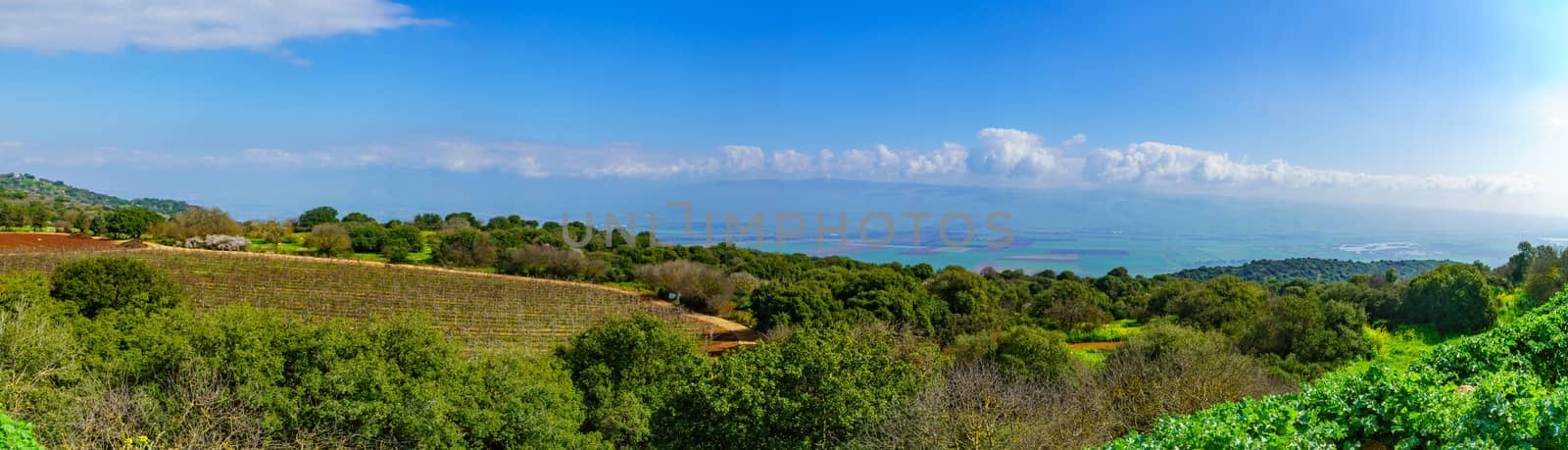
View of the Jordan valley
Stock PhotoUsername
RnDmSResolution
9183x3811pxView of the Jordan valley
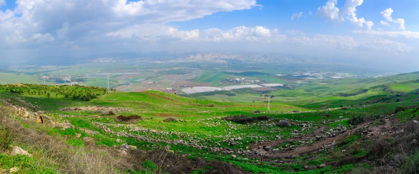

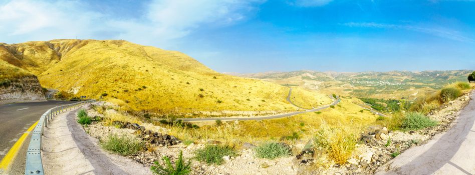
View of the Jordan valley
Stock PhotoUsername
RnDmSResolution
8914x3927pxView of the Jordan valley
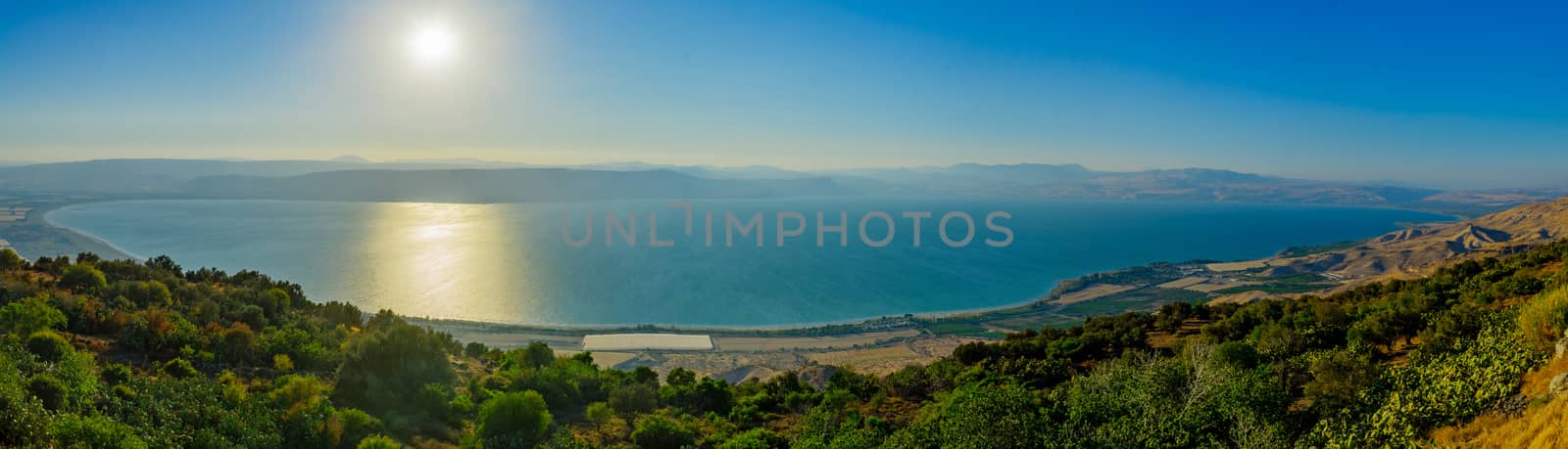
Sunset view of the Sea of Galilee
Stock PhotoUsername
RnDmSResolution
6534x3222pxSunset view of the Sea of Galilee
The Old City of Acre
Stock PhotoUsername
RnDmSResolution
4070x1867pxThe Old City of Acre


Panorama of the Golan Heights, and the Yarmouk River valley
Stock PhotoUsername
RnDmSResolution
9437x3709pxPanorama of the Golan Heights, and the Yarmouk River valley
Panorama of the Golan Heights, and the Yarmouk River valley
Stock PhotoUsername
RnDmSResolution
9738x3594pxPanorama of the Golan Heights, and the Yarmouk River valley

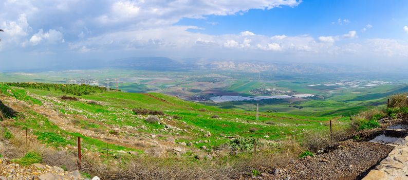
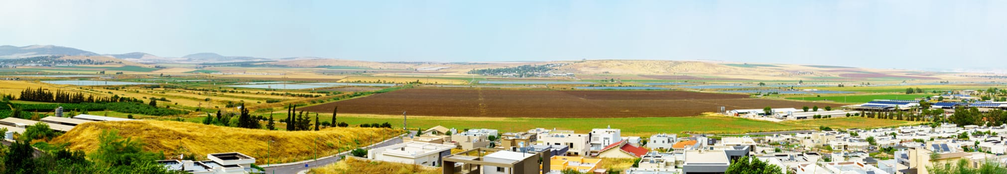
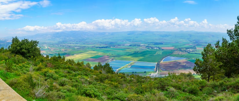
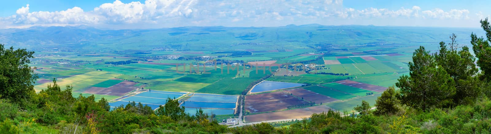
Panoramic view of Heftziba, Jezreel and Beit Shean Valleys
Stock PhotoUsername
RnDmSResolution
14212x2462pxPanoramic view of Heftziba, Jezreel and Beit Shean Valleys
Panoramic view of Haifa bay
Stock PhotoUsername
RnDmSResolution
10886x3215pxPanoramic view of Haifa bay

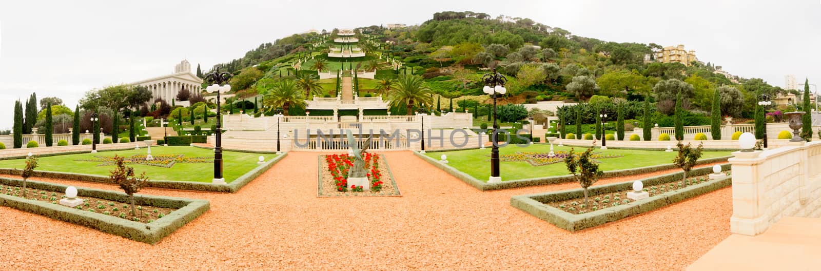
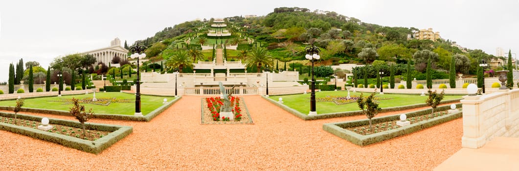
The Bahai gardens, Haifa
Stock PhotoUsername
RnDmSResolution
10252x3385pxThe Bahai gardens, Haifa

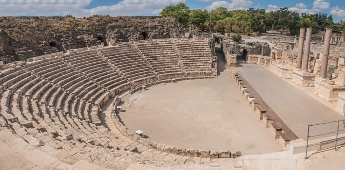
Bet Shean
Stock PhotoUsername
RnDmSResolution
5158x2549pxBet Shean
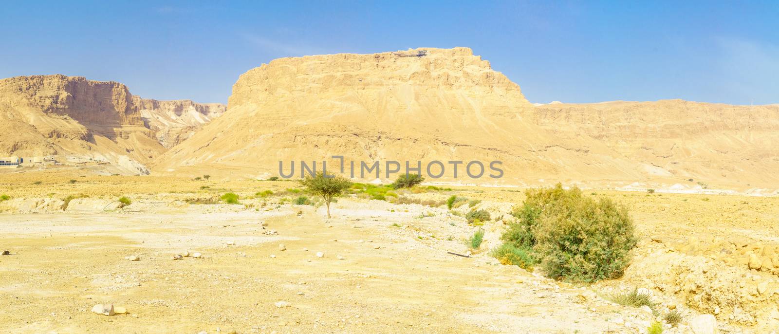
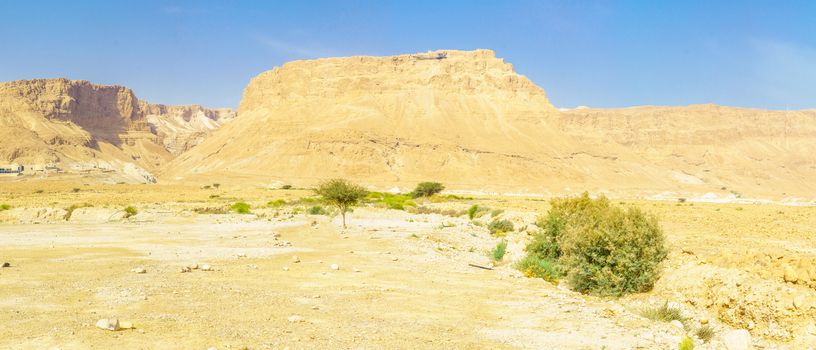
Panoramic view of the Masada fortress and the Judean Desert
Stock PhotoUsername
RnDmSResolution
9035x3873pxPanoramic view of the Masada fortress and the Judean Desert

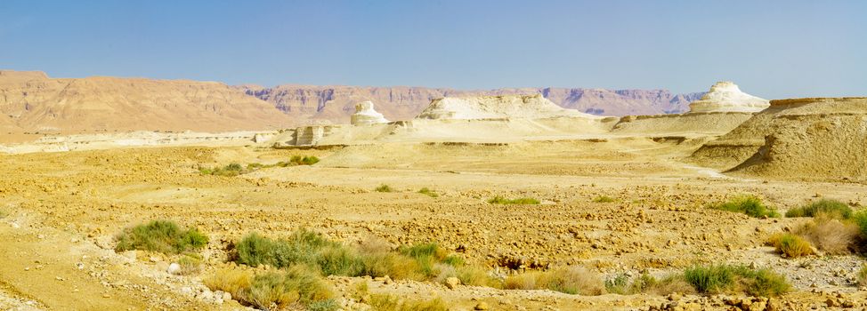
Panoramic view of landscape and rock formation, Judean Desert
Stock PhotoUsername
RnDmSResolution
9868x3547pxPanoramic view of landscape and rock formation, Judean Desert

Panoramic view of the Hula Valley landscape
Stock PhotoUsername
RnDmSResolution
9086x3852pxPanoramic view of the Hula Valley landscape
Panoramic view of the Hula Valley landscape
Stock PhotoUsername
RnDmSResolution
11316x3093pxPanoramic view of the Hula Valley landscape

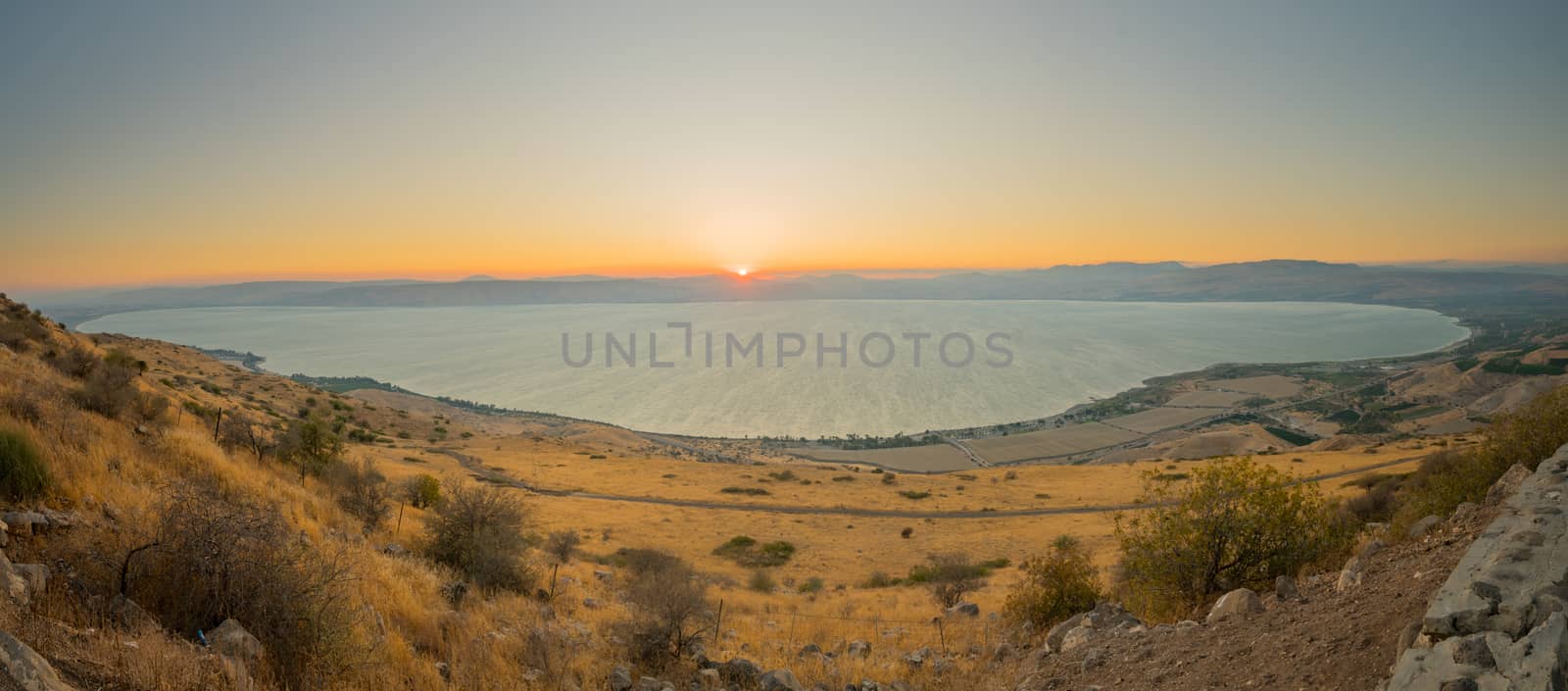
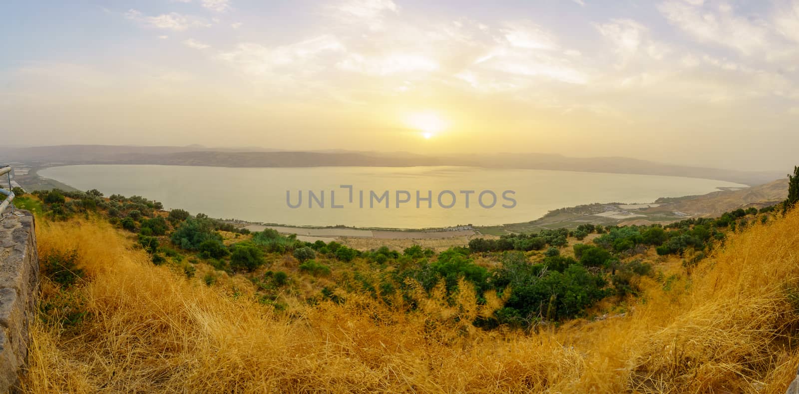
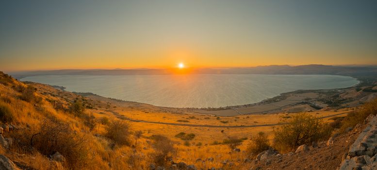
Sea of Galilee (the Kinneret lake), at sunset
Stock PhotoUsername
RnDmSResolution
8914x3926pxSea of Galilee (the Kinneret lake), at sunset
Sea of Galilee (the Kinneret lake), at sunset
Stock PhotoUsername
RnDmSResolution
8809x3972pxSea of Galilee (the Kinneret lake), at sunset

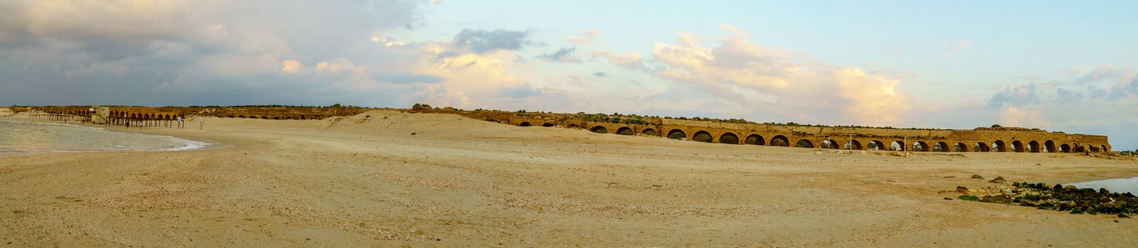
Panoramic sunset view of the beach and Roman Aqueduct, Caesarea
Stock PhotoUsername
RnDmSResolution
12670x2762pxPanoramic sunset view of the beach and Roman Aqueduct, Caesarea

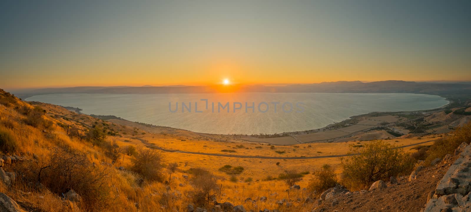
Sea of Galilee (the Kinneret lake), at sunset
Stock PhotoUsername
RnDmSResolution
9323x3754pxSea of Galilee (the Kinneret lake), at sunset
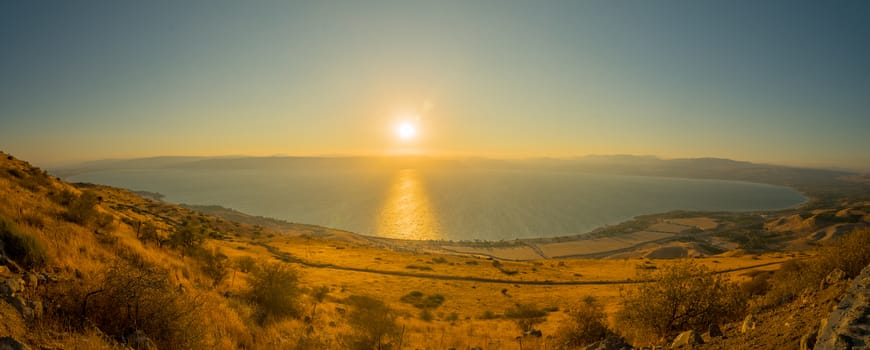
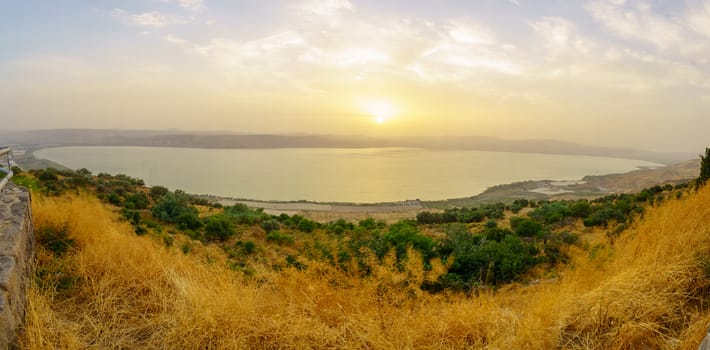
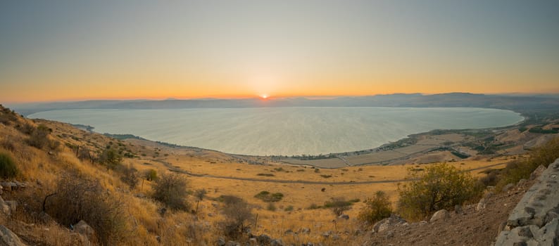
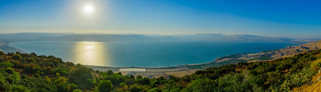
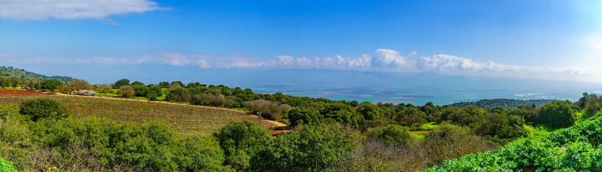
Panoramic view of the Sea of Galilee
Stock PhotoUsername
RnDmSResolution
11044x3169pxPanoramic view of the Sea of Galilee
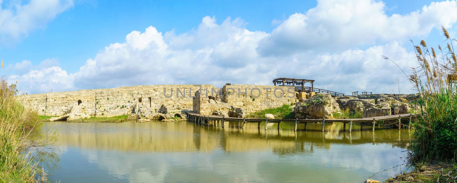
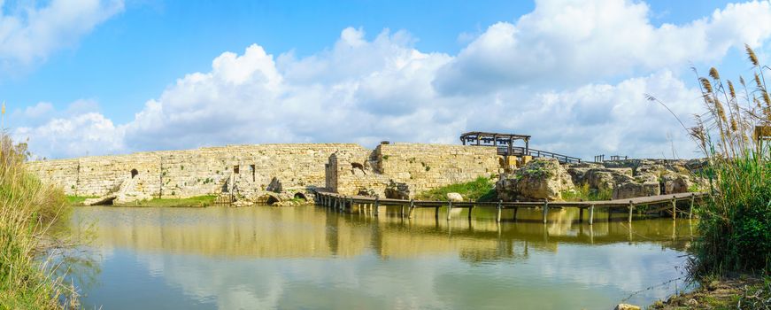
Roman era Dam and a pool, Taninim Stream Nature Reserve
Stock PhotoUsername
RnDmSResolution
8770x3526pxRoman era Dam and a pool, Taninim Stream Nature Reserve
Panoramic lLandscape and countryside in the Hula Valley
Stock PhotoUsername
RnDmSResolution
11050x3168pxPanoramic lLandscape and countryside in the Hula Valley

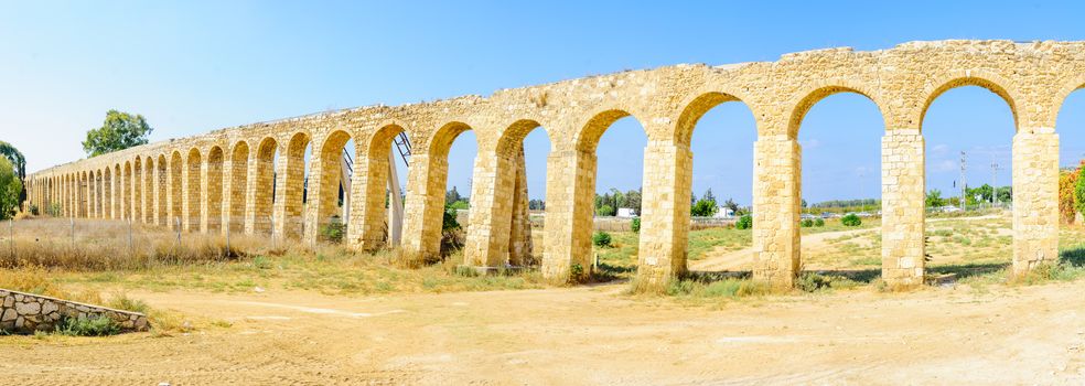
Old Aqueduct of Acre (Akko)
Stock PhotoUsername
RnDmSResolution
9920x3528pxOld Aqueduct of Acre (Akko)

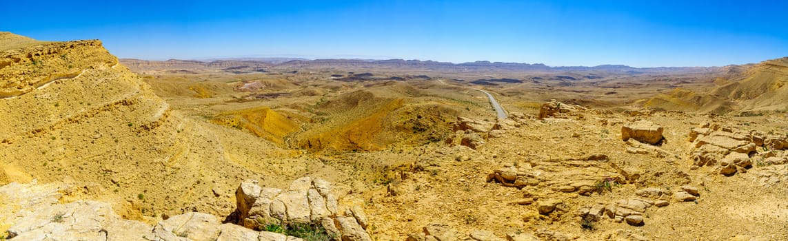
Panoramic view of Paran and the Arava desert
Stock PhotoUsername
RnDmSResolution
12627x2772pxPanoramic view of Paran and the Arava desert